20 November 2024
The St Helena Government (SHG) Geographic Information Systems (GIS) Section is proud to celebrate the 25th anniversary of GIS Day today, 20 November, with the theme “Mapping Minds, Shaping the World”.
Over the past year, the GIS Section has actively promoted GIS and its potential within SHG. Through awareness campaigns, they have successfully increased understanding and highlighted the advantages of this valuable tool. Advancements in technology have allowed them to collaborate with various departments, addressing their specific needs and providing data-driven solutions for more informed decision-making.
Established in 2005, the SHG GIS Section is the only such facility on the island. It offers analysis, mapping services, and tailored outputs to various departments and stakeholders. Recent projects include:
- Assisting the Darwin Project with reviewing National Conservation Area boundaries.
- Analysing transportation arrangements for the Education, Skills and Employment Portfolio to improve school bus services.
- Digitising internal request databases to create spatial outputs for trend analysis.
- Collaborating with Land Registry to review island parcel boundaries and rectify potential issues.
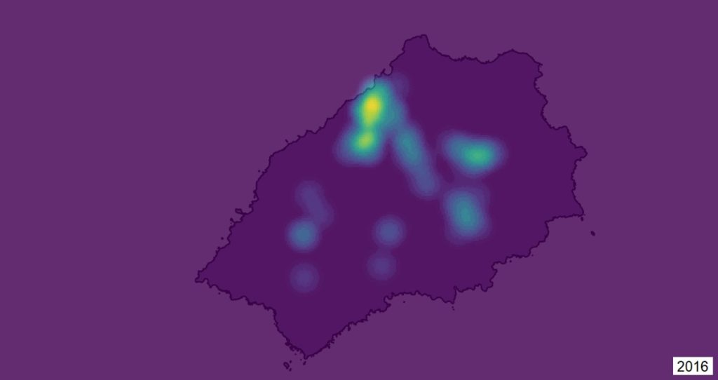
The GIS Section encourages everyone to consider how existing data, like databases or records, can be transformed into usable formats for analysis. They demonstrate this through an example where they analysed the Planning Management Office’s planning applications database. By utilising the spatial data, they created a “Hot Spot” map highlighting areas with the most development activity. This valuable information helps prioritise infrastructure improvements in areas experiencing growth. Such analysis allows departments to utilise resources effectively and achieve cost-efficient solutions.
The GIS Section prioritises staying current with evolving technology. They are actively incorporating Drone Surveying into their capabilities. Recent drone pilot training will enable the use of photogrammetry technology, which is the use of photography in surveying and mapping to ascertain measurements between objects, in creating more detailed and accurate outputs. This will enhance the department’s capacity and allow SHG to monitor its land assets effectively.
To learn more about the annual GIS Day celebration, visit: https://storymaps.arcgis.com/stories/e85242817c8e4713931f8a5aa3a93127. For further information, please contact GIS Manager Devlin Yon at devlin.yon@sainthelena.gov.sh.
Photo

A “Hot Spot” map highlighting areas with the most development activity, created for the Building Control and Planning Section.
#StHelena #GISDay2024 #MappingMindsShapingtheWorld
www.facebook.com/StHelenaGovt/