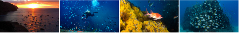
The Marine and Fisheries Conservation Section (MFCS), guided by the Marine Management Plan 2023–27 (MMP), works to conserve, protect and restore the rich biodiversity and unique ecosystems of St Helena’s Marine Protected Area (MPA). Natural resources are managed in line with the International Union for Conservation of Nature (IUCN) Category 6 sustainable use principles for the benefit of current and future generations.
The MMP sets out a five-year vision to protect St Helena’s marine environment while promoting responsible use, economic growth and community involvement. Progress is reviewed each year through a Marine Management Plan Annual Report. In 2024, an international review tool confirmed strong foundations in planning, staffing and community support, with St Helena scoring over 75%.
Currently, funding from the St Helena Government (SHG) and the Blue Belt Programme supports all of the MFCS work in fisheries, Environmental monitoring, and Community outreach. Additionally, the Darwin Initiative also funded various work areas previously. This includes sustainable fisheries management through stock assessments, tagging programmes, and analysis of logbook data in partnership with the Marine Compliance and Enforcement Section (MC&E), as well as long-term environmental monitoring of the physical, chemical, and biological conditions in St Helena’s surrounding waters. Community initiatives, invites the public to report marine sightings, and use social media and awareness campaigns to educate and involve the local community.
These efforts are helping to build a stronger understanding of local biodiversity and how best to protect it while working closely with the community.
In 2023, St Helena’s MPA was recognised as a Hope Spot. This recognition honoured St Helena’s efforts to safeguard our surrounding ocean. This also means that St Helena now joins a global ocean network of 156 Hope Spots around the world, stretching from Antarctica to the Arctic, and includes our sister island Ascension.
To stay informed about the section’s current work, the Quarterly Catch newsletter shares updates on ongoing projects and achievements within St Helena’s MPA.
Contact Details
Marine and Fisheries Conservation Section
Nature Conservation Division
Environment, Natural Resources and Planning Portfolio
Tel: +(290) 25966 Email: marine@sainthelena.gov.sh
The Marine Centre, The Wharf, Jamestown, St Helena Island, STHL 1ZZ
Ongoing scientific work
Lobster Research, Tagging and Management Around St Helena – Formerly funded by the Darwin Initiative, now funded by the Blue Belt Programme
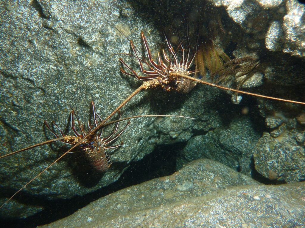
On St Helena, two lobster species are commercially important. The brown spiny lobster, known locally as crayfish (Panulirus echinatus), found at depths of 0 to 35 metres. The endemic red slipper lobster, called stump (Scyllarides obtusus), occurs at depths of 9 to 75 metres. Both species are nocturnal.
Brown Spiny Lobster, Crayfish. (Panulirus echinatus)
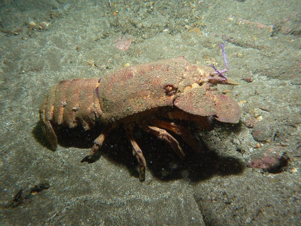
Red Slipper Lobster, Stump (Scyllarides obtusus)
A long-term monitoring programme began in 2018 under the Darwin Plus project DPLUS077: Sustainable fishery management for St Helena’s lobster populations, aiming to improve knowledge, fill data gaps, and guide sustainable management of St Helena’s lobster populations.The programme was revived in 2024 with the support of the Blue Belt Programme, tracking lobster abundance, habitat, movement, and growth to support current management measures.
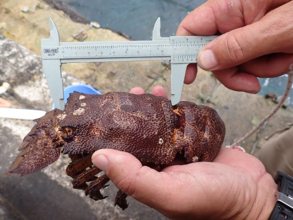
Scientist measuring the Red Slipper Lobster, Stump, as part of the ongoing Lobster monitoring project
Monitoring includes SCUBA dive surveys during the breeding seasons in November, January, and March to assess lobster abundance and habitat distribution, tagging individuals for mark-and-recapture studies, and collecting and recording biometric data. Potting surveys are also conducted, with all lobsters caught, tagged, and measured and returned to the ocean.
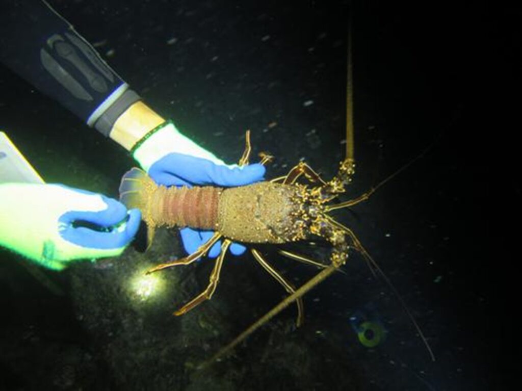
Scientist handling Brown Spiny Lobster, Crayfish whilst on SCUBA, as part of the ongoing Lobster monitoring project
The local fishing industry and community play a role by returning tags found on caught lobsters to the MFCS, which is essential for continuing the research and monitoring of the species.
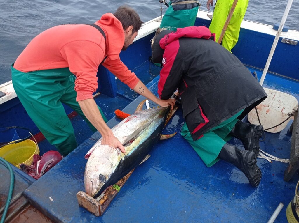
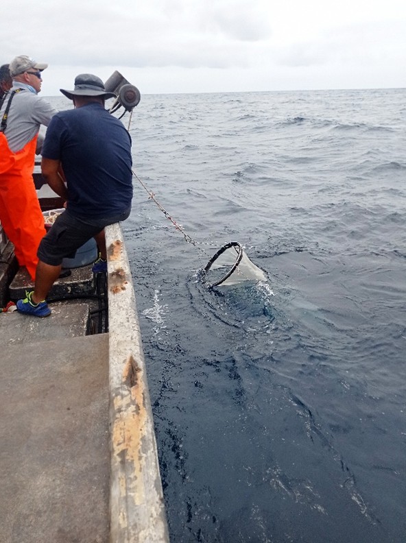
Tuna Research, Tagging and Management Around St Helena – Formerly funded by the Darwin Initiative, now funded by the Blue Belt Programme
Yellowfin (Thunnus albacares), bigeye (Thunnus obesus), and skipjack (Katsuwonus pelamis): tuna are important species for St Helena’s commercial and recreational fisheries. Research on tuna began in 2015 through a Darwin Plus project, DPLUS039: Sustainable development and management of St Helena fisheries and marine tourism. This work showed that yellowfin tuna remains in local waters for many months, providing crucial information for developing sustainable management measures.
Since 2018, the Blue Belt Programme has supported further research with expertise from the Centre for Environment, Fisheries and Aquaculture Science (CEFAS). Projects have tracked the habitat use, movements, and retention time of yellowfin and bigeye tuna, while also studying their diet to better understand pelagic biodiversity.
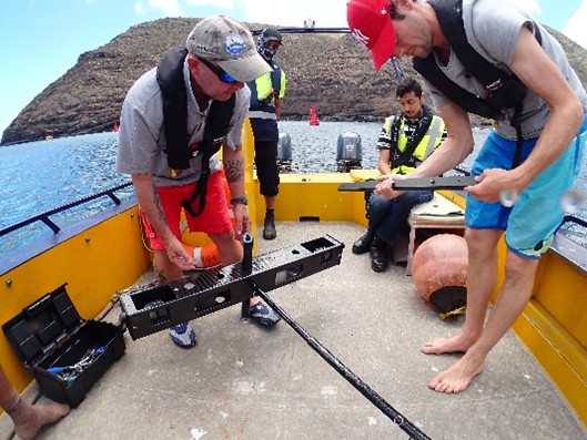
In 2018, St Helena joined the Atlantic Ocean Tropical Tuna Tagging Programme (AOTTP), funded by the International Commission for the Conservation of Atlantic Tuna (ICCAT). Over 5800 tags were deployed on yellowfin, bigeye, and skipjack tuna, including dart, satellite, and internal data storage tags. Recaptured tags have provided data on growth rates, natural mortality, exploitation rates, migration, and stock structure to support stock assessments.
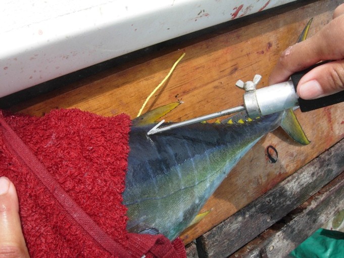
Scientist tagging yellowfin tuna (Thunnus albacares) with two conventional tags
Scientist surgically inserting an internal tag into a yellowfin tuna (Thunnus albacares)
CEFAS produced a report reviewing the status of St Helena’s tuna fishery and provided management advice. Research continues under the Blue Belt Programme with ongoing tagging and bio-sampling to ensure sustainable management of tuna in St Helena’s waters and surrounding seamounts.
The local fishing industry has been essential in deploying and recapturing tags. Continued cooperation supports sustainable tuna management, with current tagging and sampling by local fishers contributing to advisory reports.
Grouper Research, Tagging and Management Around St Helena – Formerly funded by the Overseas Territories Environment Programme (OTEP) and currently funded by the Blue Belt Programme
The rock hind grouper (Epinephelus adscensionis), locally known as jack, is a commercially important species found in shallow waters around St Helena, Ascension, and the tropical western Atlantic. Groupers begin life as females and change to males at around five to eight years of age.

Rockhind grouper, Jack (Epinephelus adscensionis)
Funding from the OTEP research on grouper, beginning with a project from 2005 to 2007, which studied the species and recommended management measures, including a minimum landing size. To continue this work, a grouper tagging project was then established under the Blue Belt Programme in 2018 and is still ongoing. The MFCS continues to collect data on population status, growth, reproduction, movement, and habitat use. The data captured through tag and recapture helps set sustainable catch limits and informs management measures to sustain the fish stock.
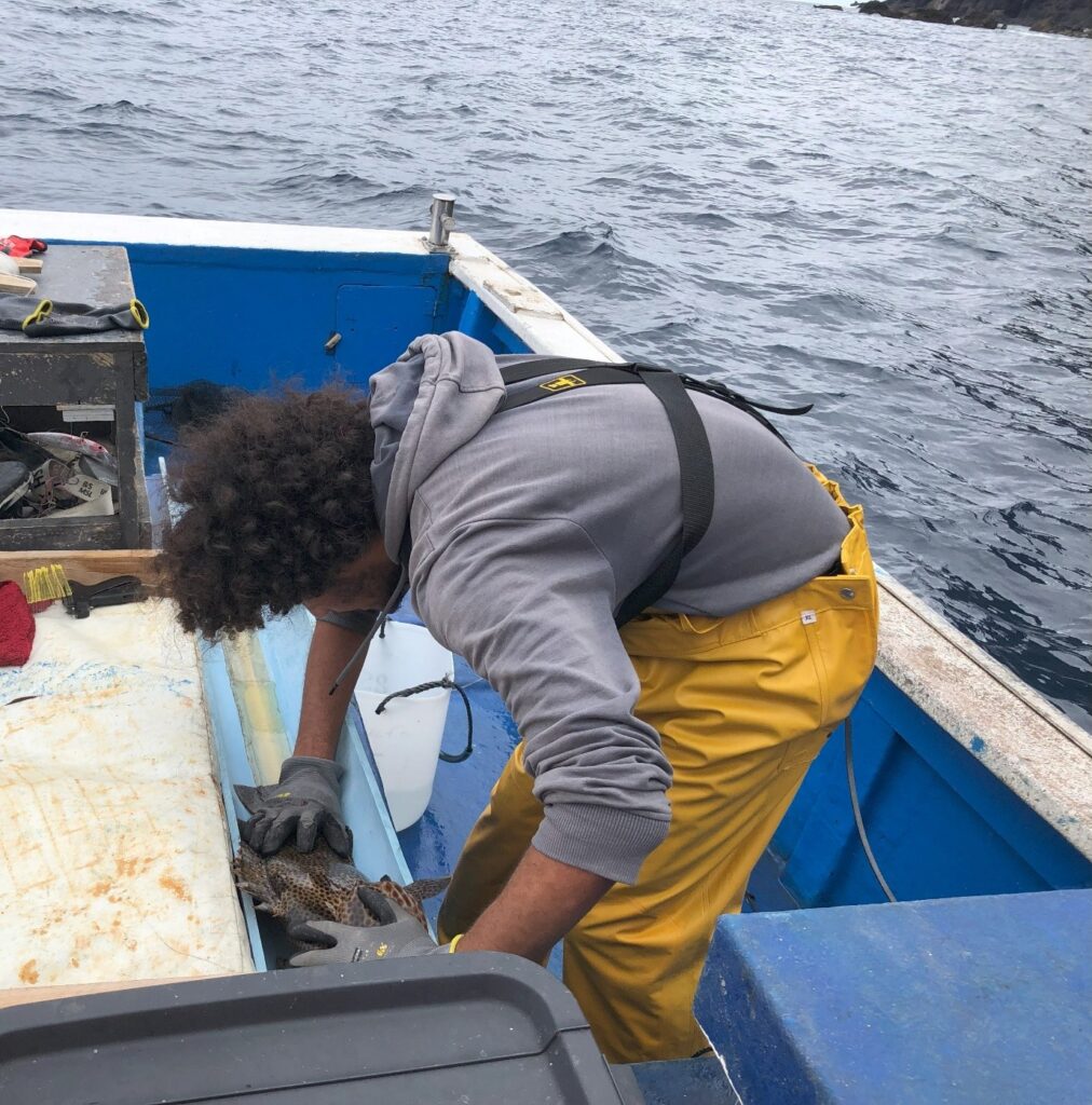
MFCS work experience student conducting tagging and biometric sampling on Grouper
Using data from the previous Overseas Territories Environment Programme (OTEP) and Blue Belt supported projects, CEFAS produced a report that provides scientific advice to support government policy and the sustainable management of grouper. Research continues with ongoing tagging and bio-sampling.
The local fishing industry and community play a role by returning tags found on caught grouper to the MFCS, which is essential for continuing the research and monitoring the species.
Ichthyoplankton Research and Monitoring Around St Helena – Funded by the Blue Belt Programme
Ichthyoplankton, a type of zooplankton, are the eggs and larval stages of fish that drift through the water column. To collect samples, a plankton net is lowered into the water at locations around the island. At the same locations, a CTD device is also deployed to measure salinity, temperature, and depth, which helps to understand the water conditions. Together, these methods allow the eggs and larvae to be gathered and studied for this research.
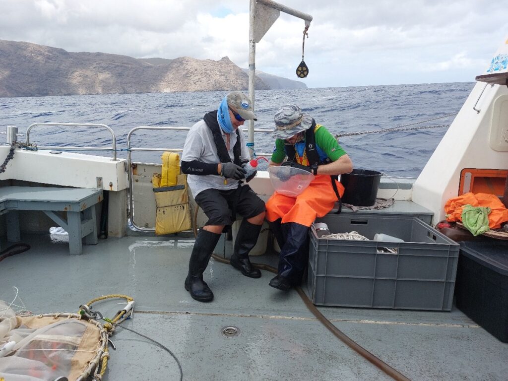
Scientist filtering plankton samples
This baseline study is important because it provides reliable information on the number and types of small organisms at the base of the food chain, helping the MFCS understand the overall health and productivity of the marine ecosystem. The programme also supports monitoring of key species, and improves our understanding of recruitment into fish stocks. It can also help to aid our current understanding of spawning for commercially important fish species and detect environmental factors that may affect fish populations.
Fisheries Observer Programme in St Helena – Previously funded by the Darwin Initiative, now funded by St Helena Government
As part of the DPLUS039 – Sustainable development and management of St Helena’s fisheries and marine tourism, The MFCS staff were trained as local fisheries observers.
Currently, the MFCS aims to uphold ICCAT’s recommendation of five percent observer coverage by placing one observer on a fishing vessel each week to continue monitoring fisheries.
This work involves fisheries observers going on fishing vessels to record information about fishing activities, including the types and amounts of fish caught. This helps monitor fisheries and support sustainable management of marine resources.
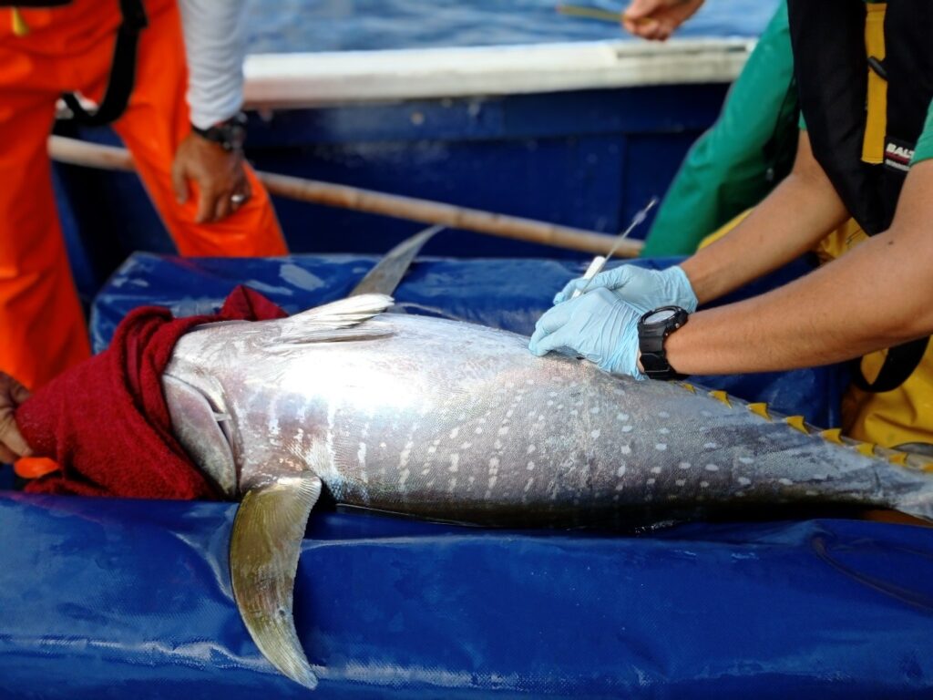
MFCS observers measuring a yellowfin tuna
Open-ocean Research and Monitoring Around St Helena
The St Helena Open-ocean Time-Series (SHOTS) was developed from the two-year Darwin-funded project, DPLUS070: Oceanographic Influences on the St Helena Pelagic Ecosystem, to monitor seasonal changes in the waters around St Helena and support understanding of the marine environment.
During the project, six sites around the island were studied. At each site, a CTD device was lowered into the water to measure salinity, temperature, and depth to understand the water conditions. Zooplankton samples were also collected at three leeward sites to study environmental drivers and primary productivity that feeds the local marine life.
One offshore site, Dawsons, was chosen for long-term monitoring because it is the first station where seasonal changes occur before expanding to the island’s surrounding waters. Regular monitoring of this site helps track patterns and changes in the ocean over time and supports sustainable management of St Helena’s marine ecosystem.
Scientists retrieving SHOTS plankton net
Underwater Visual Census Monitoring Around St Helena – Formerly funded by the Darwin Initiative, now funded by St Helena Government
Underwater Visual Census (UVC) is a method where trained divers observe and record fish and invertebrate species in the water. Since 2013, the MFCS has used UVC, alongside photo quadrats, which are underwater photographs of small sections of the seafloor, to monitor the nearshore marine environment. These methods help the MFCS to understand which species are present, how many there are, and the condition of the habitat over a long period of time.
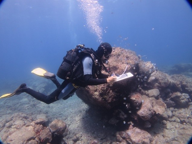
Divers conducting annual underwater visual census (UVC) surveys
Baseline Oceanographic Monitoring Around St Helena – Formerly funded by the Darwin Initiative and the Blue Belt Programme, now funded by St Helena Government
This project collects baseline oceanographic data to assess what are considered normal conditions for St Helena’s MPA and to understand the impacts of run-off caused by heavy rain.
Monitoring is carried out by deploying logging sensors at fixed moorings around the island to measure dissolved oxygen, salinity, and temperature every 30 minutes. A CTD device is also deployed at these sites to collect detailed information on salinity, temperature, and depth.
Monitoring Semi-Pelagic Fish Movements Around Pinnacles and Wrecks on St Helena Using Acoustic and Video Survey Methods – Funded by St Helena Government
The MFCS studied the movement of semi-pelagic species, which was achieved using acoustic telemetry, a method that tracks fish by recording signals from internal tags surgically inserted inside them. An array of 10 acoustic receivers were positioned around the island to capture movement data over an 18 month period. The study worked in partnership with the BRUVS project to identify the residency and movement of these fish between pinnacles and wrecks within St Helena’s MPA. Tagging for this study was completed in 2024, with 12 tags deployed. The acoustic receiver array has been collected, and all data is currently being analysed to better understand the movement and habitat use of these species.
Tag retention
For anyone that reports or returns evidence of the recapture of any of the tagged species listed above with correct information, will be provided with a monetary reward:
• Species name
• Length at capture
• Date of capture
• Location of capture
• Tag number
Information can be returned to the Marine Centre, Wharf, St Helena or emailed using marine@sainthelena.gov.sh
Conventional tags:
Tuna: Any conventional tags returned to the MFCS will be rewarded up to £10.
To land yellowfin and bigeye tuna, they need to meet the minimum landing requirements of 67cm. Both yellowfin, bigeye and skipjack tuna is all measured using fork length.
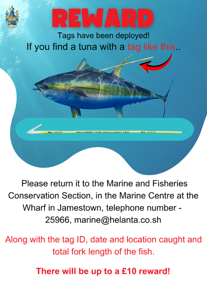
Any conventional tuna tags that are found washed up on Sandy Bay Beach, that are brought to the MFCS are also given a £5 reward. Only the date that the tag was found will need to be given to the section.
Grouper: Any grouper that is caught and released or caught and retained with all information listed above will be given a £5 reward.
To land grouper, they need to meet the minimum landing requirements of 35cm, which is measured using total length.

Lobster: Any lobster species (Brown Spiny Lobster and Red-Slipper Lobster) that is caught and released or caught and retained with all information listed above will be given a £5 reward.
To land brown spiny lobster, they need to meet the minimum landing requirements of 8.5cm to land red-slipper lobster, they need to meet the minimum landing requirements of 10cm. Both species are measured via the carapace.
Acoustic tags
Any semi-pelagic species that is caught and released or caught and retained with all information listed with an external orange tag, where an acoustic tag is present will be given a £10 reward.
Semi-pelagic species are measured using fork length.
Data Storage Tags (DST)
Any yellowfin tuna that are caught and released or caught and retained with all information listed with an external orange tag, where a DST tag is present will be given a £100 reward.
Satellite Tags
Any yellowfin tuna that are caught and released or caught and retained with all information listed with an external satellite tag, will be given a £100 reward.
Completed/Archived Projects
Studying Fish Habitats Around St Helena Using Underwater Cameras – Funded by the Blue Belt Programme
Using Blue Abacus’ – Baited Remote Underwater Video Systems, known as BRUVS, which are underwater cameras that use bait to attract fish and record their behaviour. They are deployed around St Helena to observe how semi-pelagic species, which live partly in open water and partly near the seabed, use pinnacles, steep underwater rock formations that provide important habitats, as well as other areas. This research provides insight into the pressures these species face from human activities and supports efforts to protect marine life.
The MFCS now also use the BRUVS equipment as part of an ongoing Global Ocean Wildlife Analysis Network (GOWAN) which works across all the Uk overseas territories to answer different research questions.
Shows the team setting up the BRUVS system
Seabird project
Biological data collection – Stable isotopes – Funded by St Helena Government
Between 2013-2019 feather samples were collected for their use in dietary analysis from five seabird species on St Helena: band rumped storm petrels (Hydrobates castro), red-billed tropicbird (Phaethon aethereus), masked boobies (Sula dactylatra), sooty terns (Onychopion fuscatus), black noddy (Anous minutus) and brown noddy (Anous stolidus).
Biological data collection – Blood – Funded by St Helena Government
Blood samples were collected from breeding band rumped storm petrels and roosting red-billed tropic birds. Samples that were collected were used to examine genetic structure.
Colony/distribution monitoring – Funded by St Helena Government
Initial monthly colony monitoring research was collected from 2009-2019 around Shore Island, Great Stone Top and the Lots Wife, Sandy Bay area. To establish an observational baseline for seabird populations on the island.
Nesting – Funded by St Helena Government
Nest monitoring was conducted from 2009-2021 to monitor the nest success and productivity of three seabirds: band-rumped storm petrels, red-billed tropic birds and masked boobies.
Mark and Recapture – Funded by St Helena Government
In 2007-2021, a mark and recapture study (under the St Helena Ringing Scheme) was carried out on the eight-resident seabird species found on island. This study provided estimations on longevity, survival, and tracking. Additionally, morphometric data, age and sex of individuals was collected.
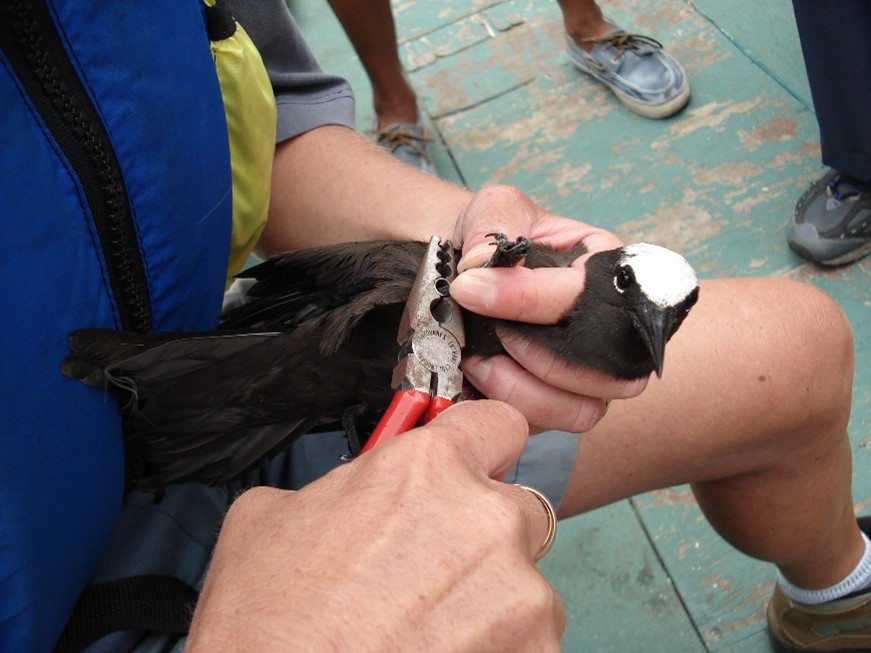
Scientist ringing Black Noddy (Anous minutus)
GPS tracking of Red-Billed Tropicbirds – Funded by Enterprise St Helena
GPS loggers were tail mounted to incubating and chick rearing red-billed tropicbirds to map foraging areas during three breeding seasons, to understand foraging ranges.
Cavity attendance – Funded by St Helena Government
Cavity activity was monitored using a combination of physical observation and infrared motion sensor cameras from 2013-2018. All Red-billed tropicbirds found using the cavities were identified through ringing and the activity was recorded e.g. nesting, roosting or on territory.
Predator trapping – Funded by St Helena Government
Routine mammalian predator trapping was completed during annual, Red-billed tropicbird monitoring and tracking from August to December 2014-2016.
Monitoring surveys – Funded by OTEP
Nine, six monthly seabird surveys were conducted by boat between 2004-2011. The total number of adult seabirds seen around St Helena’s coastline, including birds in flight during each survey were tallied by a minimum of two surveyors to provide an estimate of species abundance.
Taxonomic and conservation status of storm petrels in the South Atlantic – Funded by the Darwin Initiative
DPLUS018 project aimed to clarify whether storm petrels nesting on St Helena and Ascension are the same species that occurs elsewhere in the Atlantic or whether they constitute one or more species to science.
GPS tracking of Red-Billed Tropicbirds – Funded by Enterprise St Helena
GPS loggers were tail mounted to incubating and chick rearing Red-billed Tropicbirds to map foraging areas during three breeding seasons to understand foraging ranges.
Whale shark Project – Funded by the Darwin Initiative and St Helena Government
St Helena has two main important sectors for the island’s vision of self-sufficiency – tourism and commercial fishing. During the Darwin Plus project DPLUS039 in 2017, the MFCS focused on monitoring the whale shark, or locally called the Bone Shark (Rhincodon typus). Tagging was conducted and allowed the MFCS to understand the shark’s use of St Helena’s MPA, their seasonality and the depths that they dive daily. From this project an ecotourism code of conduct was put in place. The project also focused on the photo identification of St Helena’s whale sharks.
In the 2018 whale shark season, the whale shark identification project was continued, but funded through St Helena Government.
Oceanographic influences on the St Helena pelagic ecosystem – Funded by the Darwin Initiative
The DPLUS070 project established a basic understanding of the seasonal operation of pelagic ecosystems that underpins St Helena’s fisheries and tourism industries and evaluated how oceanography influences that system.
Education and Outreach
Social Media
Public awareness is vital to deepening our collective understanding of the importance of the marine environment. For the local community, the ocean is more than just a natural resource, it is a way of life, a source of income, and an important part of community identity. Protecting it is not only essential for the island’s ecological well-being, but also for preserving the livelihoods and heritage of our community.
The MFCS team raises awareness through social media and local platforms such as newspapers and radio stations. By sharing regular updates on scientific findings, ongoing projects, and key reports, the team helps ensure that the community remains informed and engaged.
Stay connected and informed by following St Helena MPA on Facebook, Instagram, and X.
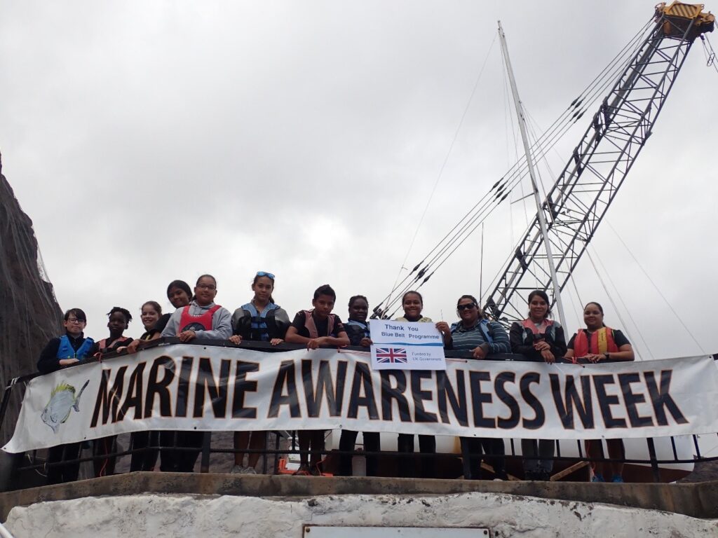
Marine Awareness Week
Since its first launch in 2003, Marine Awareness Week has been held annually, with each year featuring a unique and engaging theme, aiming to promote a deeper understanding of our marine environment among the general public, including students from both primary and secondary schools.
Throughout the week, the MFCS team delivers theme-based presentations, informative displays, and a range of engaging marine-related activities. These include interactive games, quizzes, themed fancy dress events, and even disco nights, designed to both educate and inspire participants of all ages to appreciate and protect our ocean and its diverse ecosystems.
Marine Tourism
Marine Tour Operator Accreditation Scheme
In June 2023 a new marine regulation was introduced that created the concept of regulated activities within the MPA. This regulation requires marine tour operators to obtain a licence in order to conduct or facilitate certain activities.
To support this, the Marine Environmental Accredited Tour Operator Certification Scheme was created. The training programme is designed to build environmental awareness among local marine tour operators and focuses on safeguarding marine habitats along with the plants and animals that live there. The training is delivered in-house by certified MFCS trainers to ensure a high standard of operation.
For anyone wishing to observe marine wildlife on St Helena, they are encouraged to use accredited marine tour operators as they have been trained to conduct tours responsibly, helping to protect the marine environment while ensuring a safe and sustainable experience.
Marine Sightings
In 2004, as part of an OTEP project called Establishment of a Monitoring Scheme and Awareness Programme for Seabirds and Turtles at St Helena, the public was invited to help track marine life by reporting their sightings.
Sightings can include turtles, dolphins and whales, sharks, rays, unusual birds, fish, and other marine creatures.
Anyone who spots marine life can either share their observations with the MFCS or add their sightings directly into iRecord St Helena, via iRecord St Helena app or website. This information is needed to make a full record:
- The date of the sighting
- The species observed
- Number of individuals seen
- Location of sightings
- Person who recorded the sighting
MMP Annual Report
St-Helena-MMP-Annual-Report-2023_24
St-Helena-MMP-Annual-Report-2024_25
Quarterly Catch Newsletter
Quarterly Catch (Q1 Jan – Mar 2026)
Useful Links
- Rock Bullseye Landing Size
- Spearfishing Prohibited Areas
- Closed Season For Spearfishing
- Review Of St Helena Tuna Fishery Status And Management Advice
- Marine Environment Accreditation Certification Scheme 2023
- Marine Tourism Policy
- Policy for Marine Species Interaction
- Whale Sharks around St Helena
- Guide to diving in St Helena
- Whales and dolphins around St Helena
- Seabirds of St Helena