This project produced a series of high-detail island-wide maps and datasets, showing a baseline of habitat types, soils and other associated environmental information. The purpose of this information is to support island conservation and future management activities by helping to understand biodiversity, species (particularly endemic) geographic distribution and dynamic, protect and restore native habitats, control invasive species, aid sustainable agriculture, land resource planning and water resource management.
These maps and dataset outputs were derived from a combination of analysis of multi-spectral satellite imagery, ground-truthing field work and analysis of relevant historical and current datasets available. Additionally, training was provided to local stakeholders in order for this data to be updated over time, via a ‘living map’; subjects include an introduction to remote sensing and how environmental data is derived, field work methodology and data collection, mapping techniques. The data is be available for any organisation involved in decision making to do with land and species management.
The project has generated the following reports:
The project has generated the following soil data for St Helena: To follow after publication.
Output maps from the project can be accessed via the links below. They can also be accessed in more detail here on our web map: https://data.saeri.org/saeri_webgis/lizmap/www/ (map can be found at the bottom of the page).
If you see anything that is incorrect or needs updating, please use the following form to submit changes to the St Helena Government GIS department.
Habitat Map Segment Update Form
Further details about habitats can be found in the below document:
Help on Habitats – Habitat Classification
Habitat
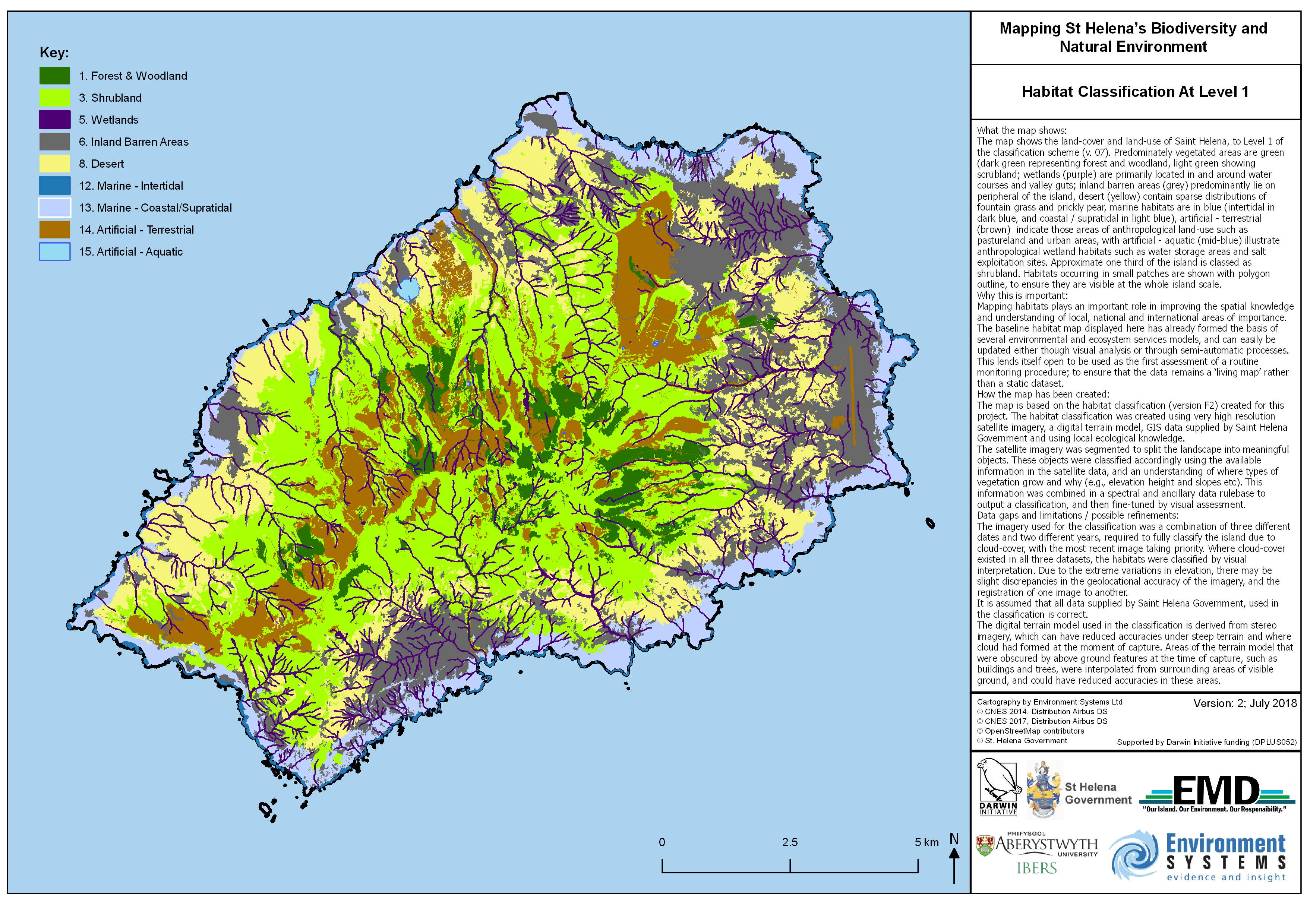
Habitat Classification At Level 1
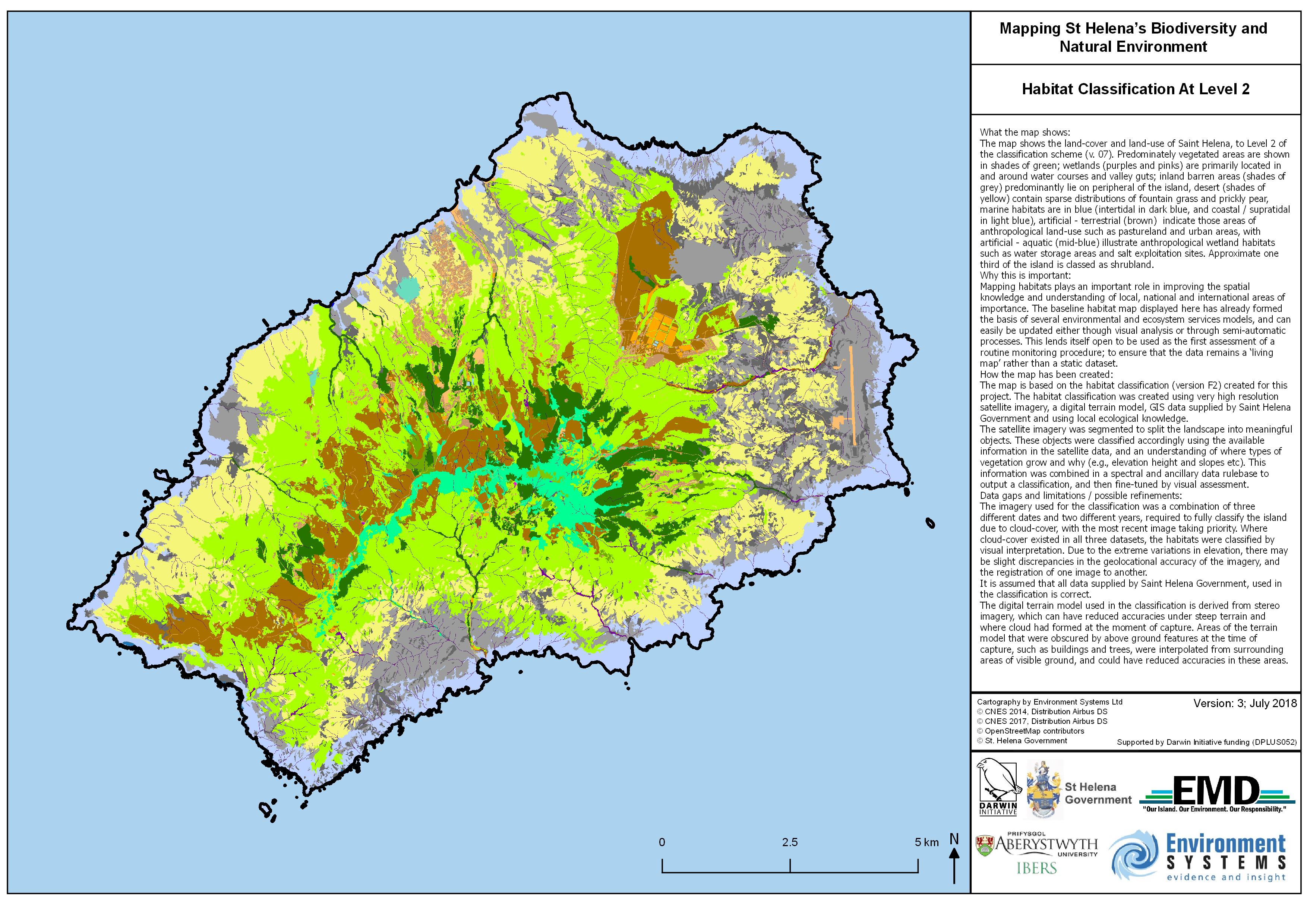
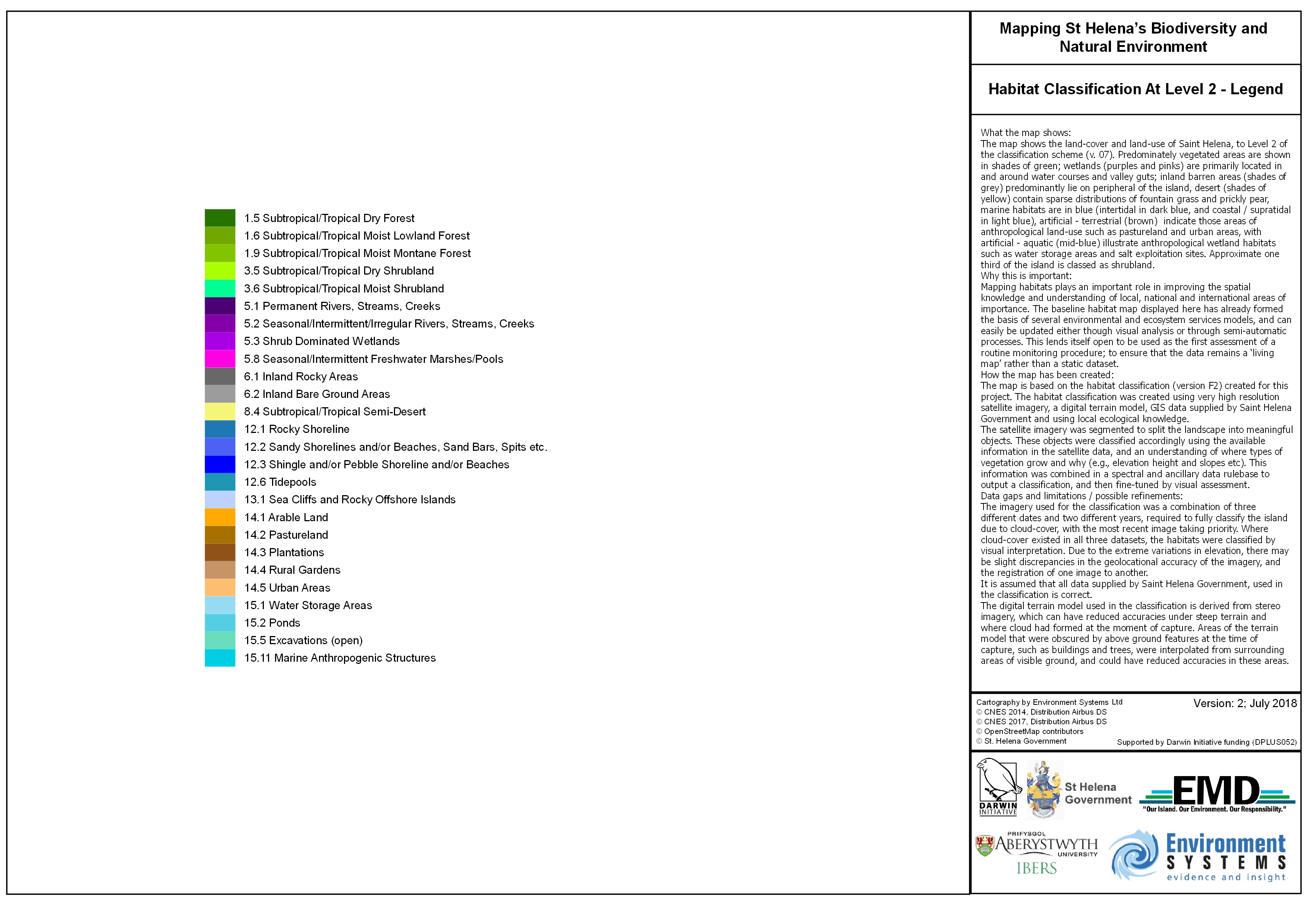
Habitat Classification At Level 2 & Legend
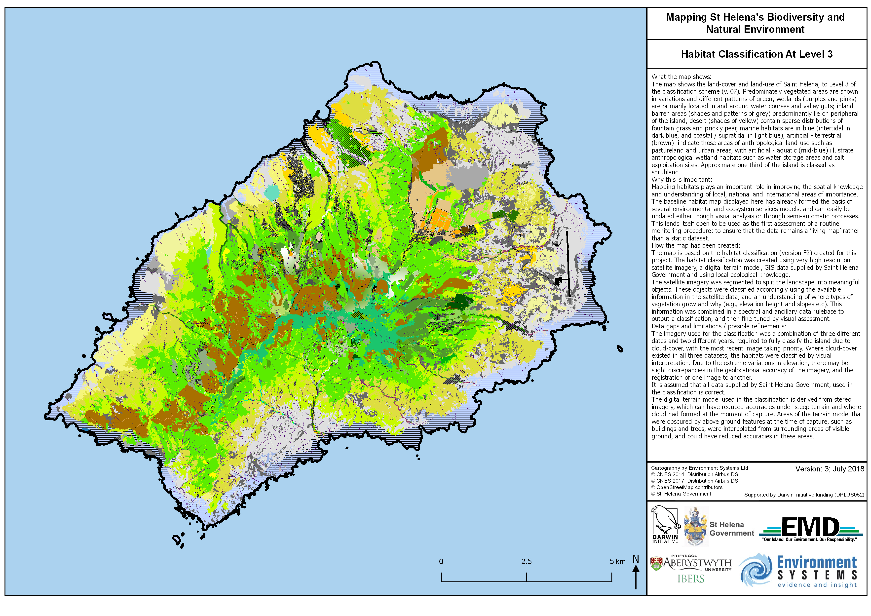
Habitat Classification At Level 3 & Legend
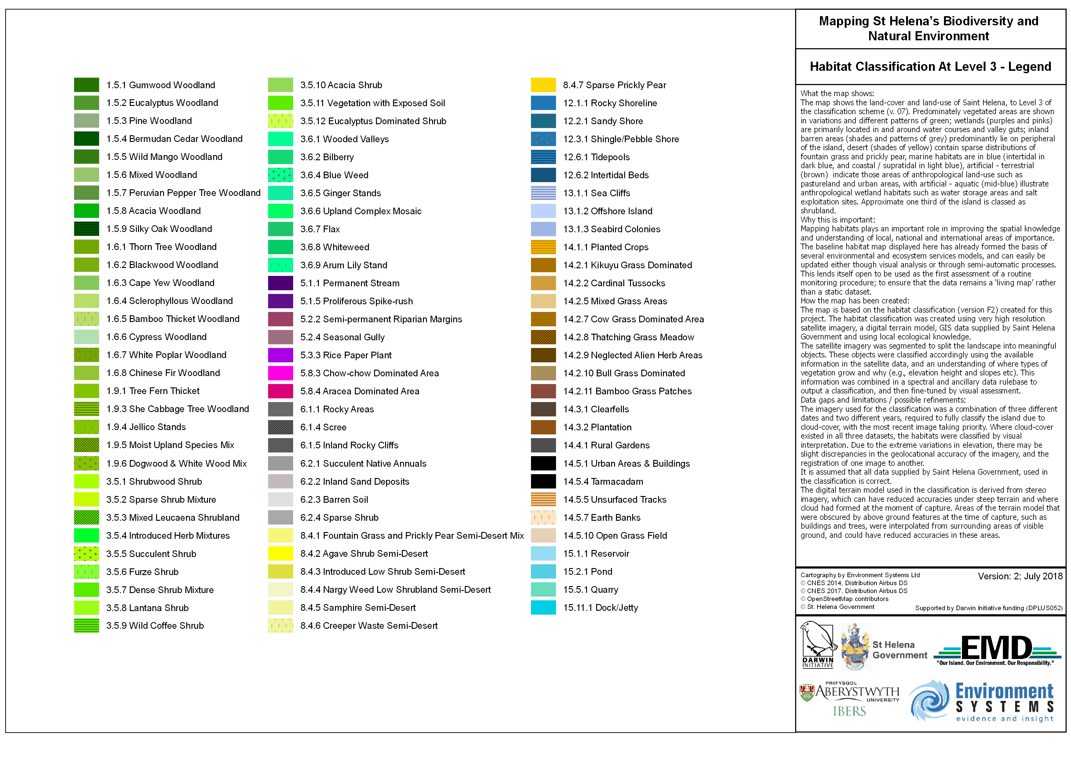
Biodiversity
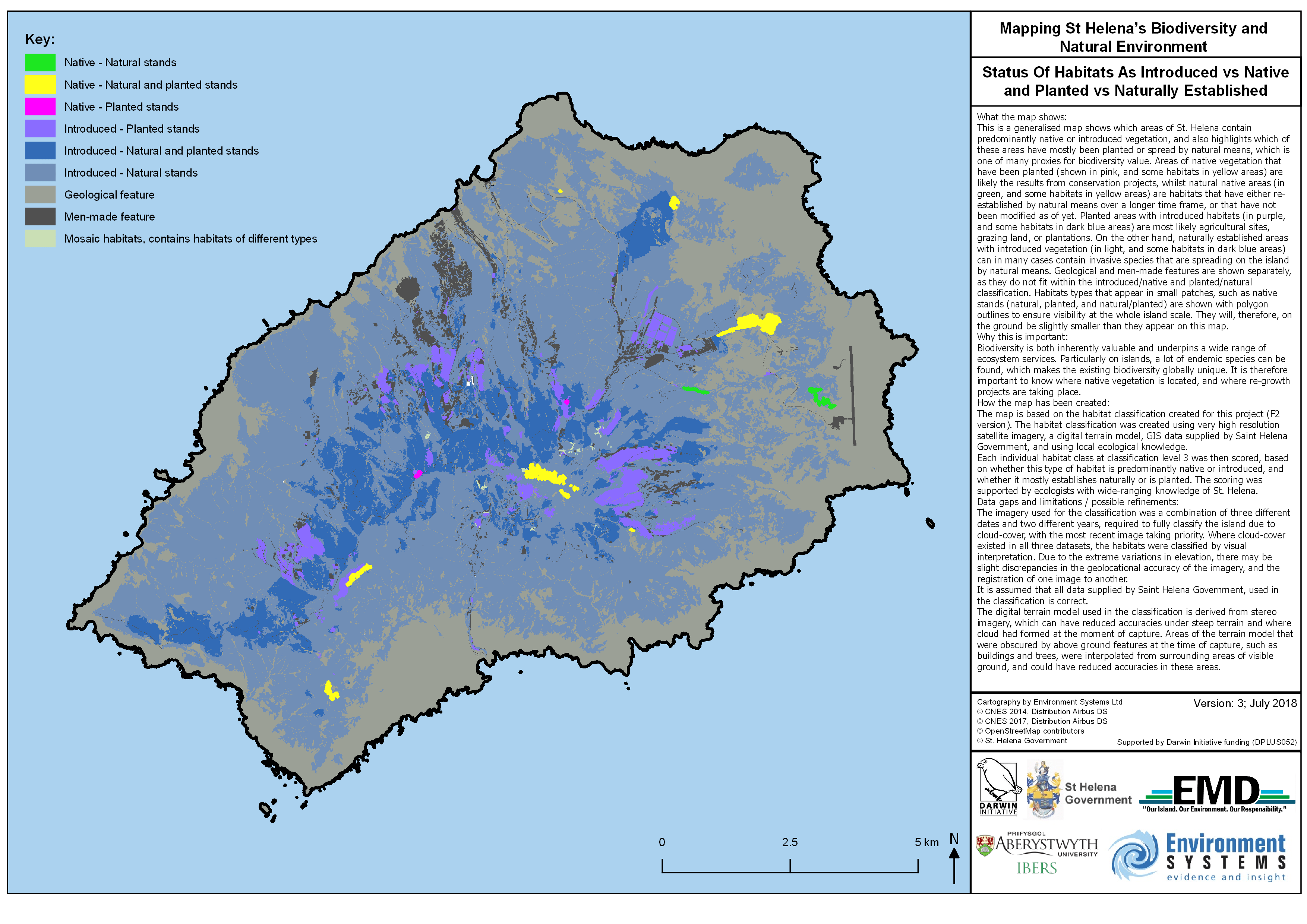
Status Of Habitats As Introduced vs Native and Planted vs Naturally Established
Soils
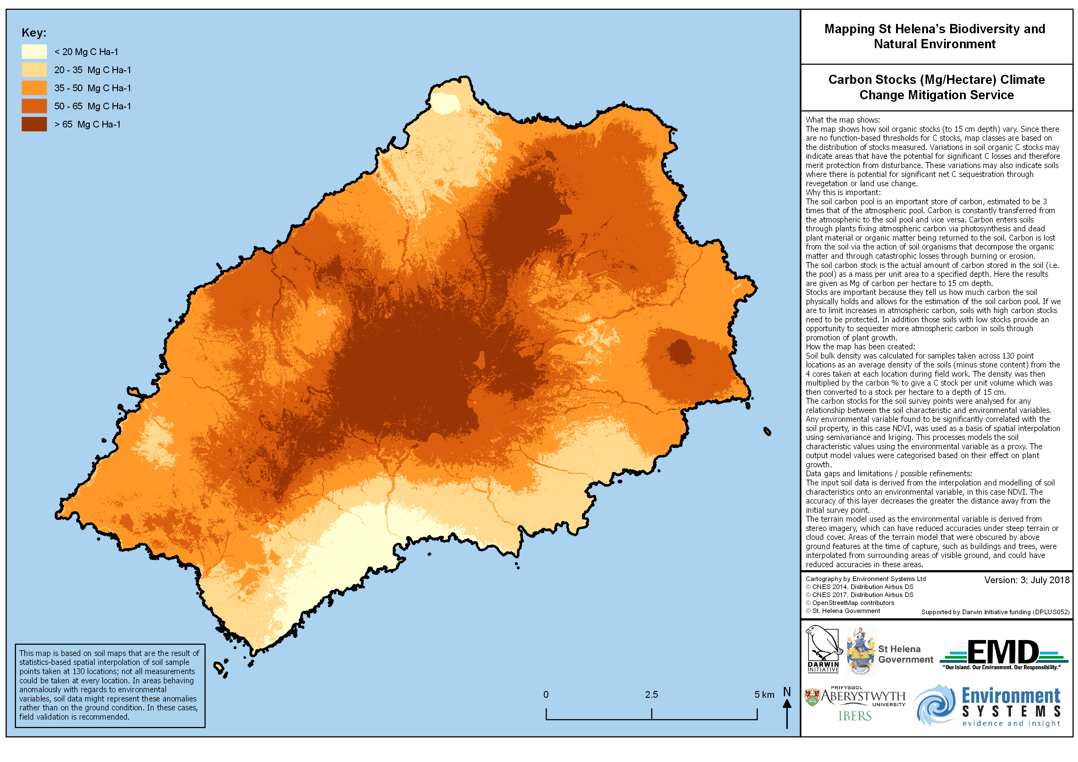
Carbon Stocks (Mg/Hectare) Climate Change Mitigation Service
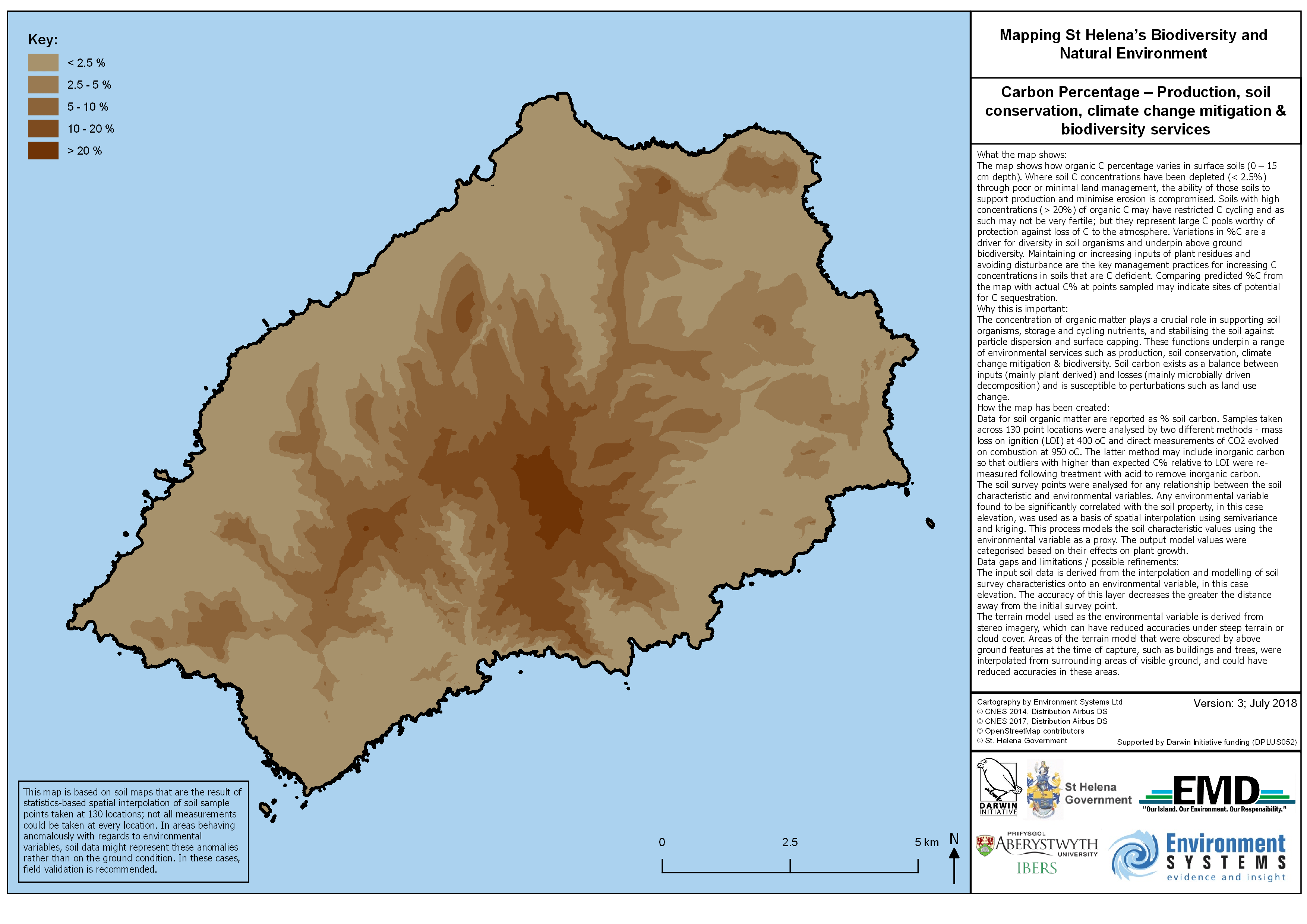
Carbon Percentage – Production, soil conservation, climate change mitigation & biodiversity services
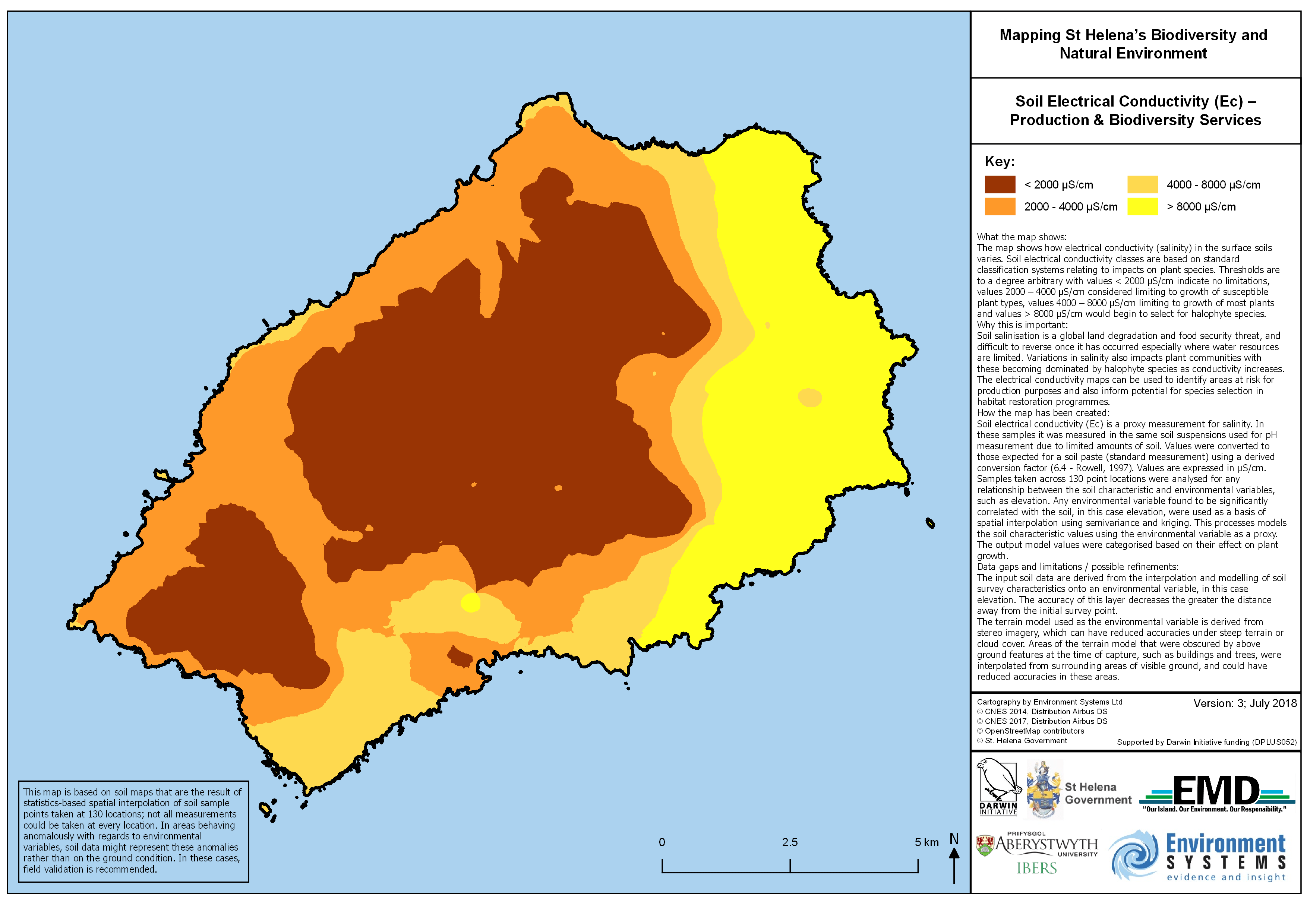
Soil Electrical Conductivity (Ec) – Production & Biodiversity Services
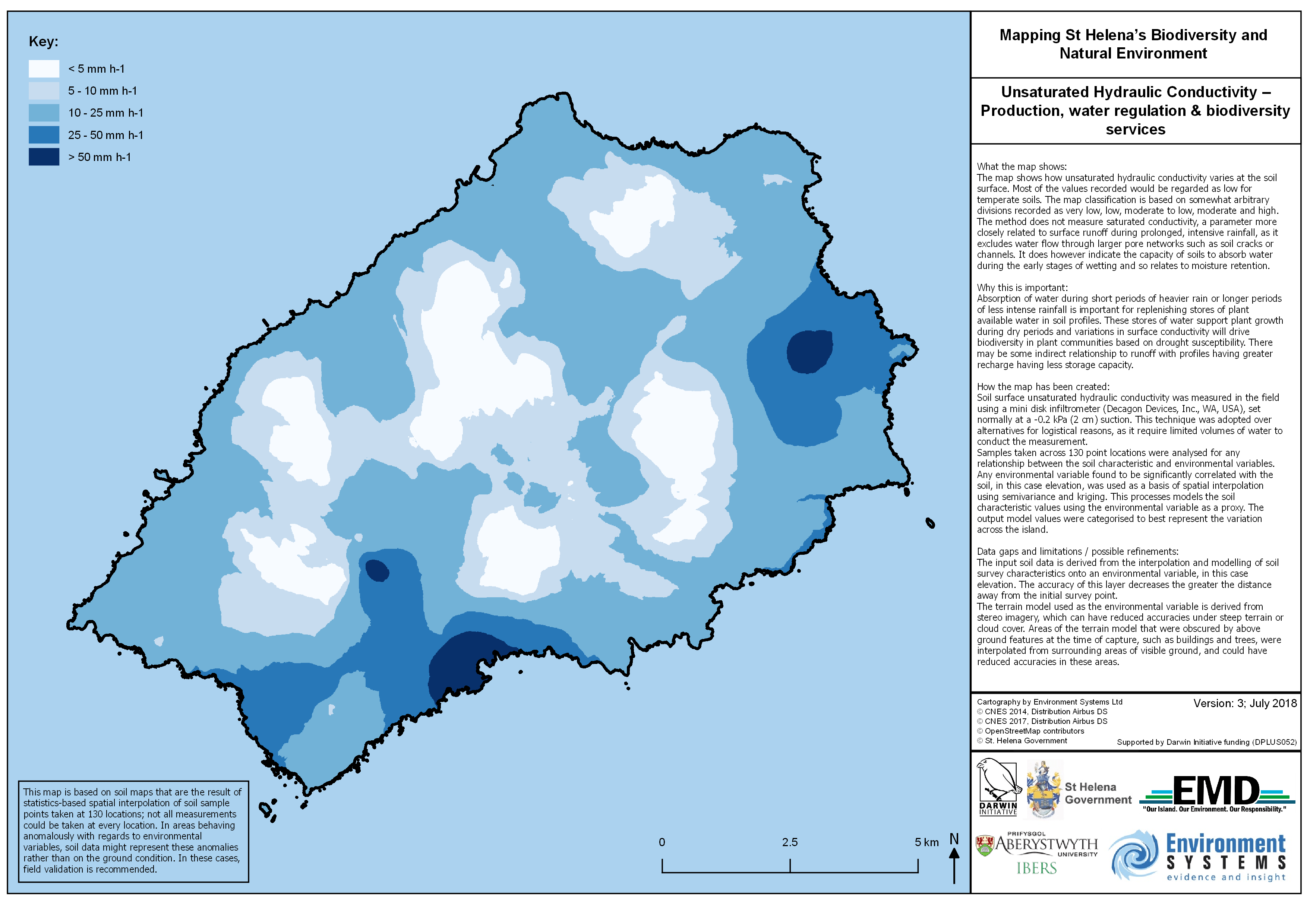
Unsaturated Hydraulic Conductivity – Production, water regulation & biodiversity services
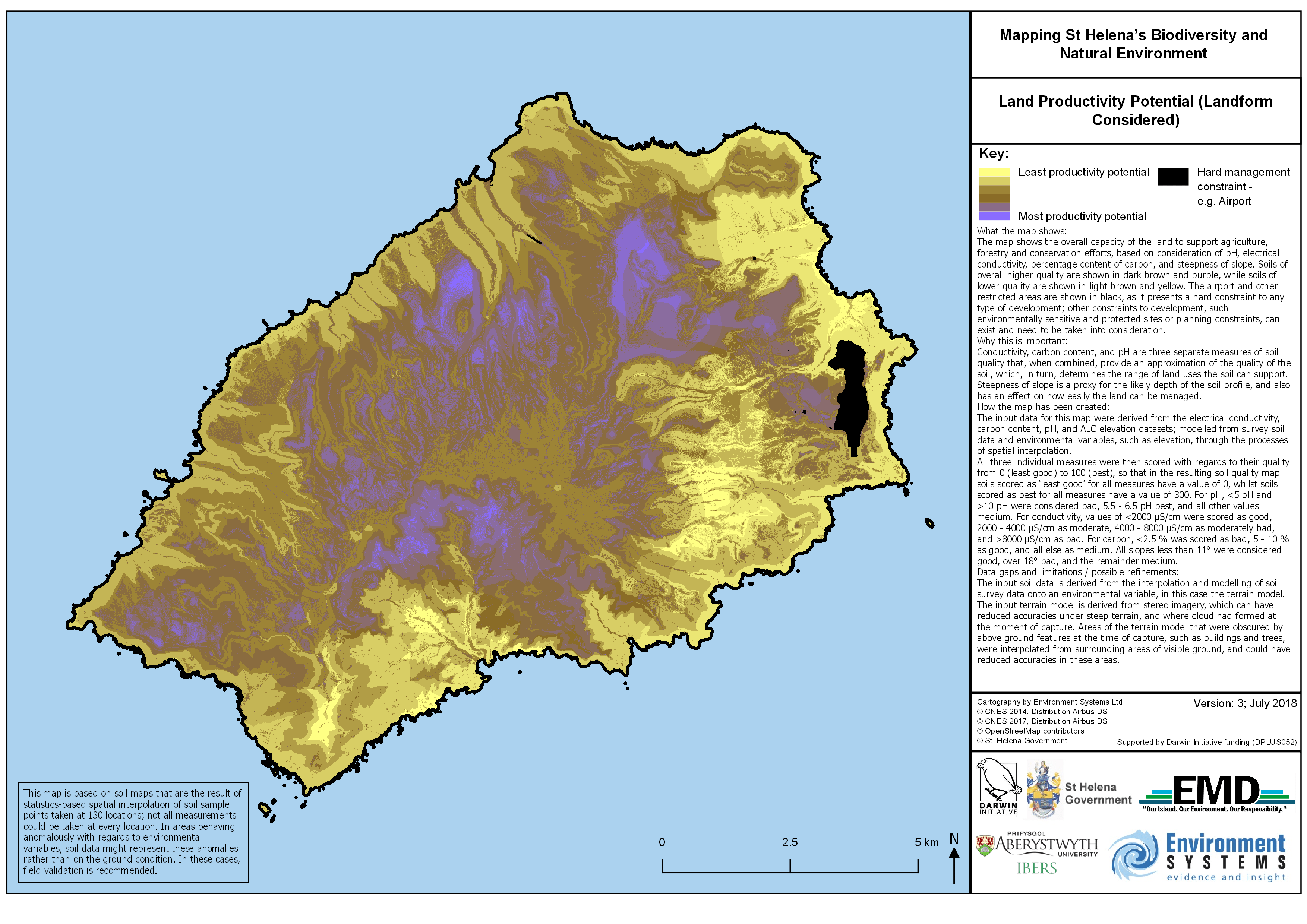
Land Productivity Potential (Landform Considered)
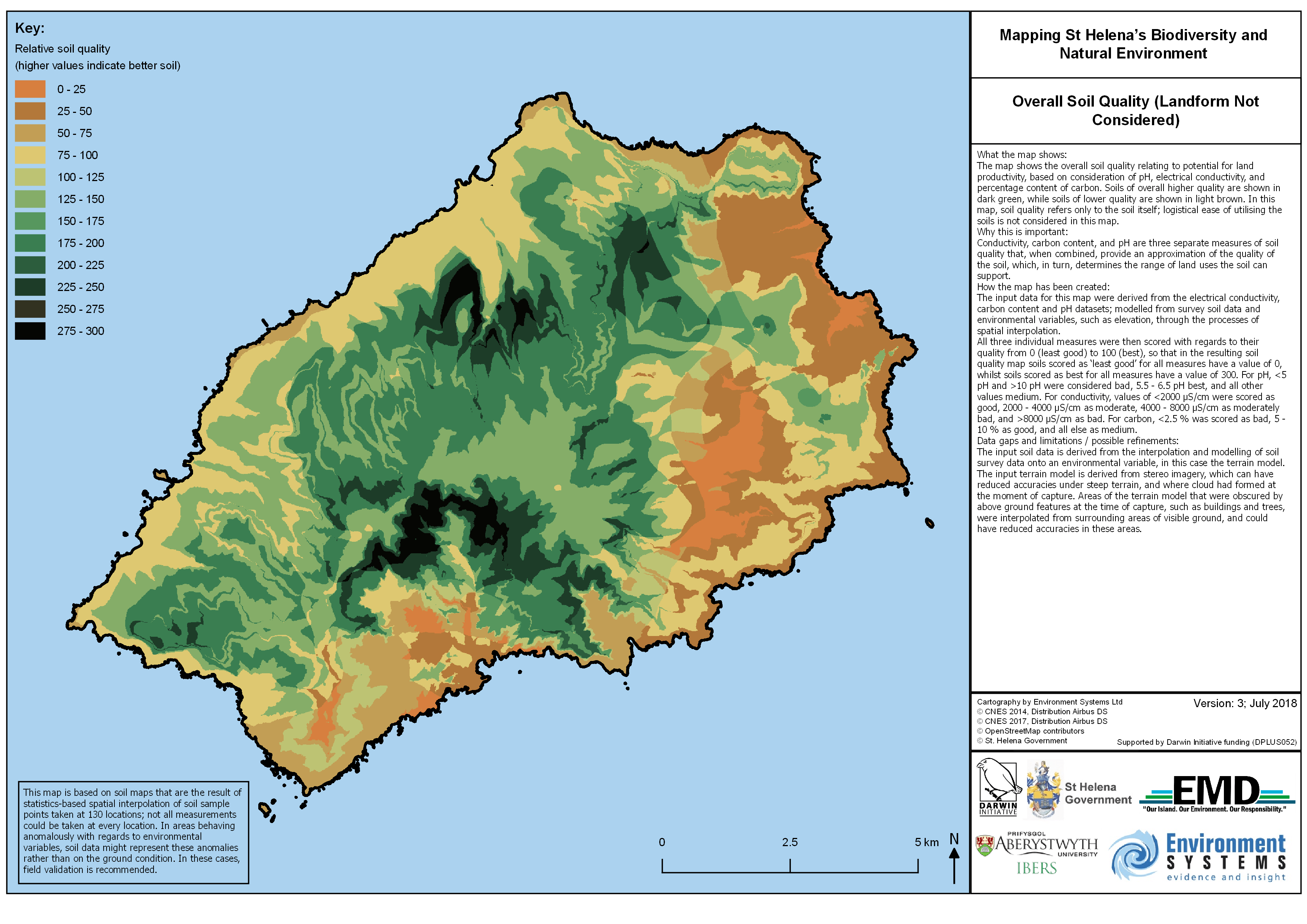
Overall Soil Quality (Landform Not Considered)
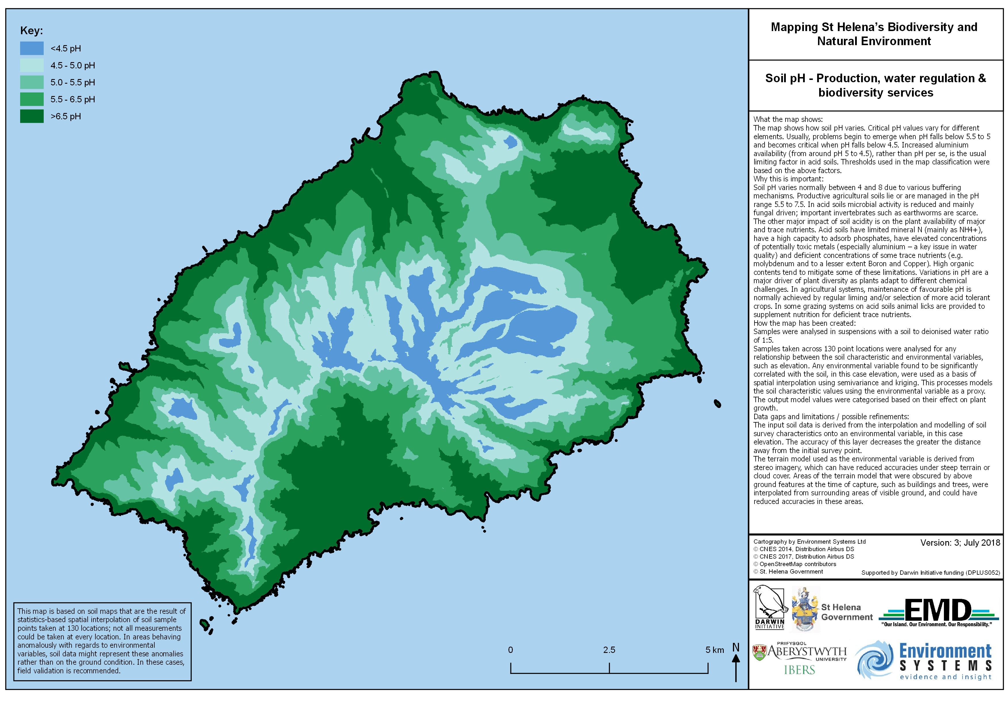
Soil pH – Production, water regulation & biodiversity services
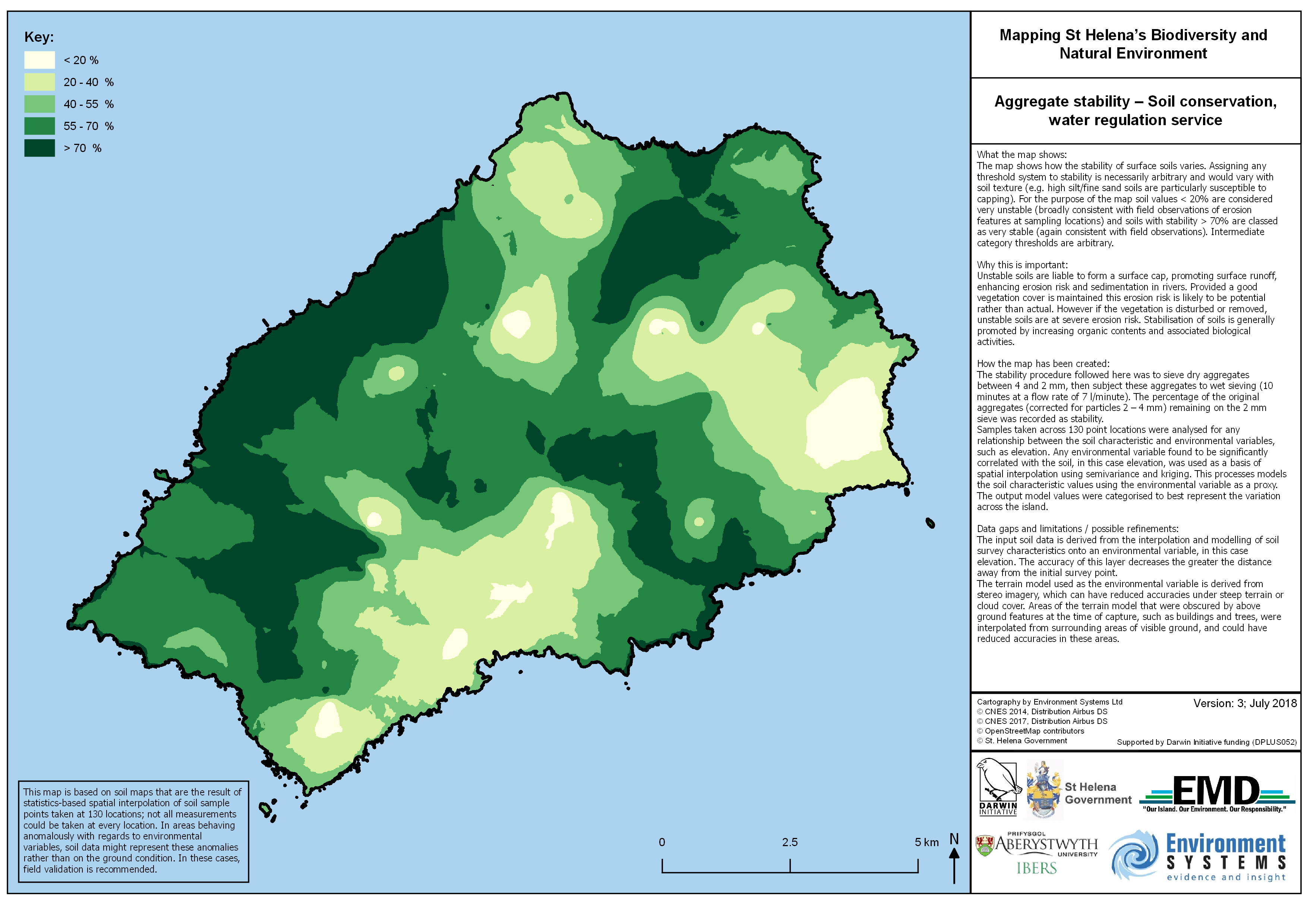
Aggregate stability – Soil conservation, water regulation service
Erosion
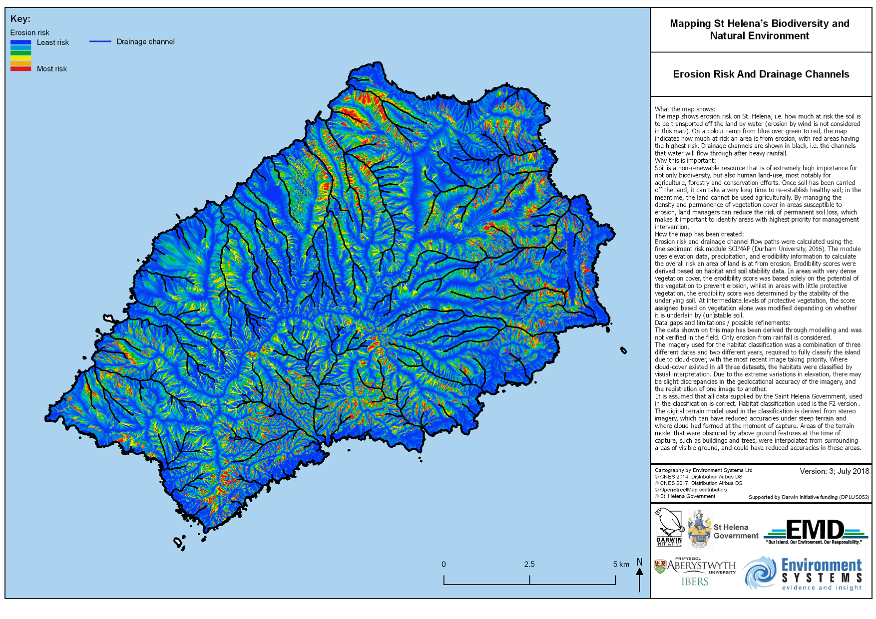
Erosion Risk And Drainage Channels
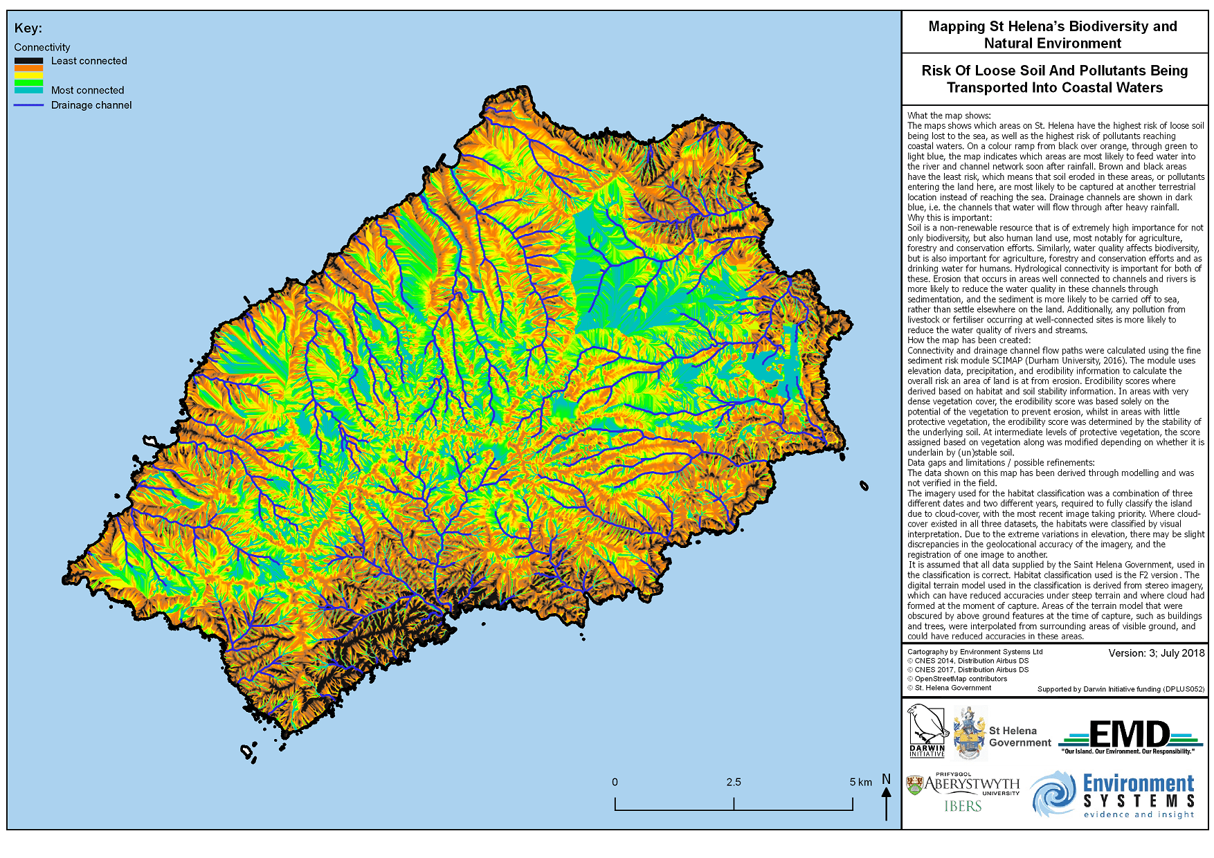
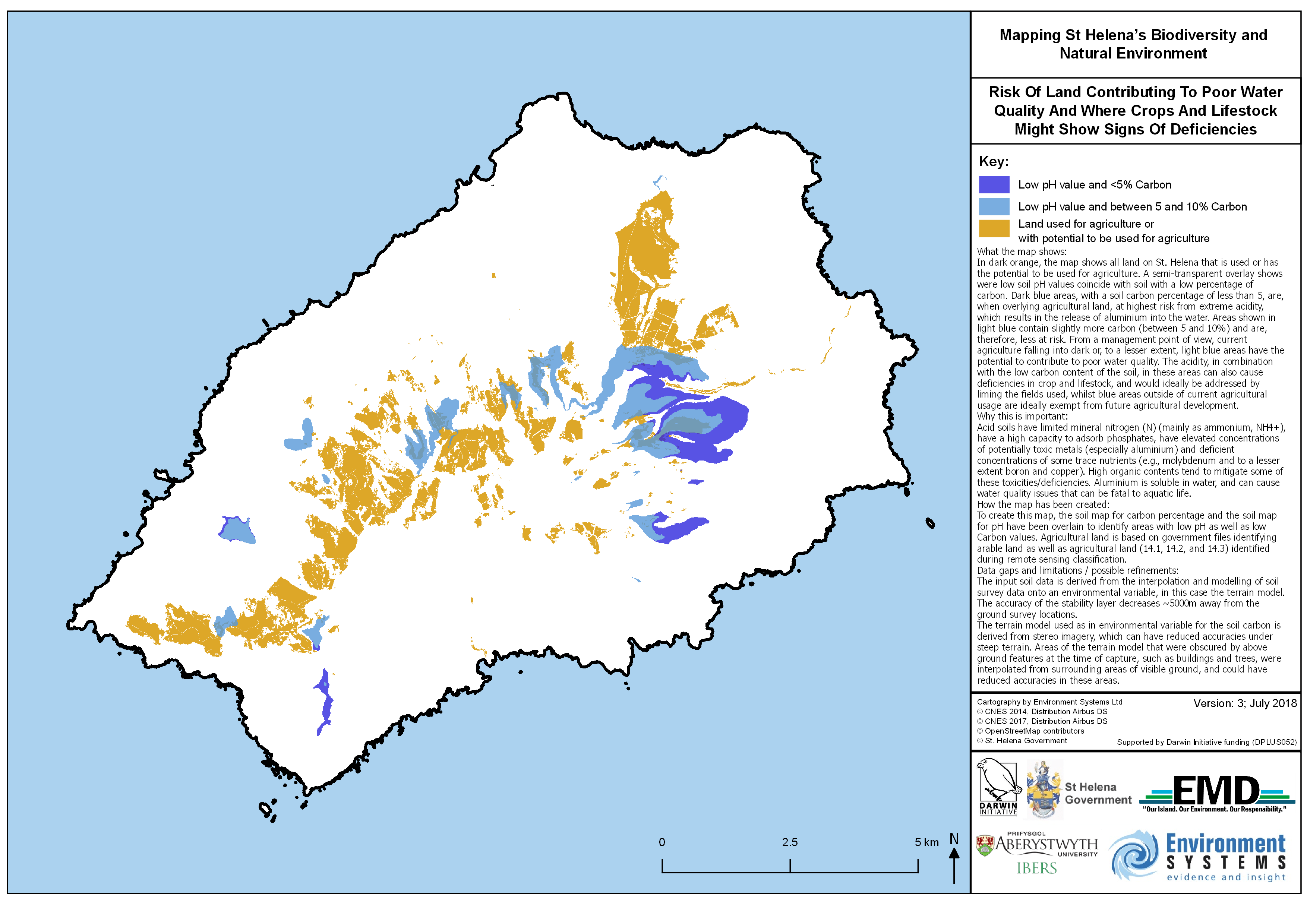
Risk of Loose Soil And Pollutants Being Transported Into Coastal Waters
Opportunities To Manage Erosion Risk
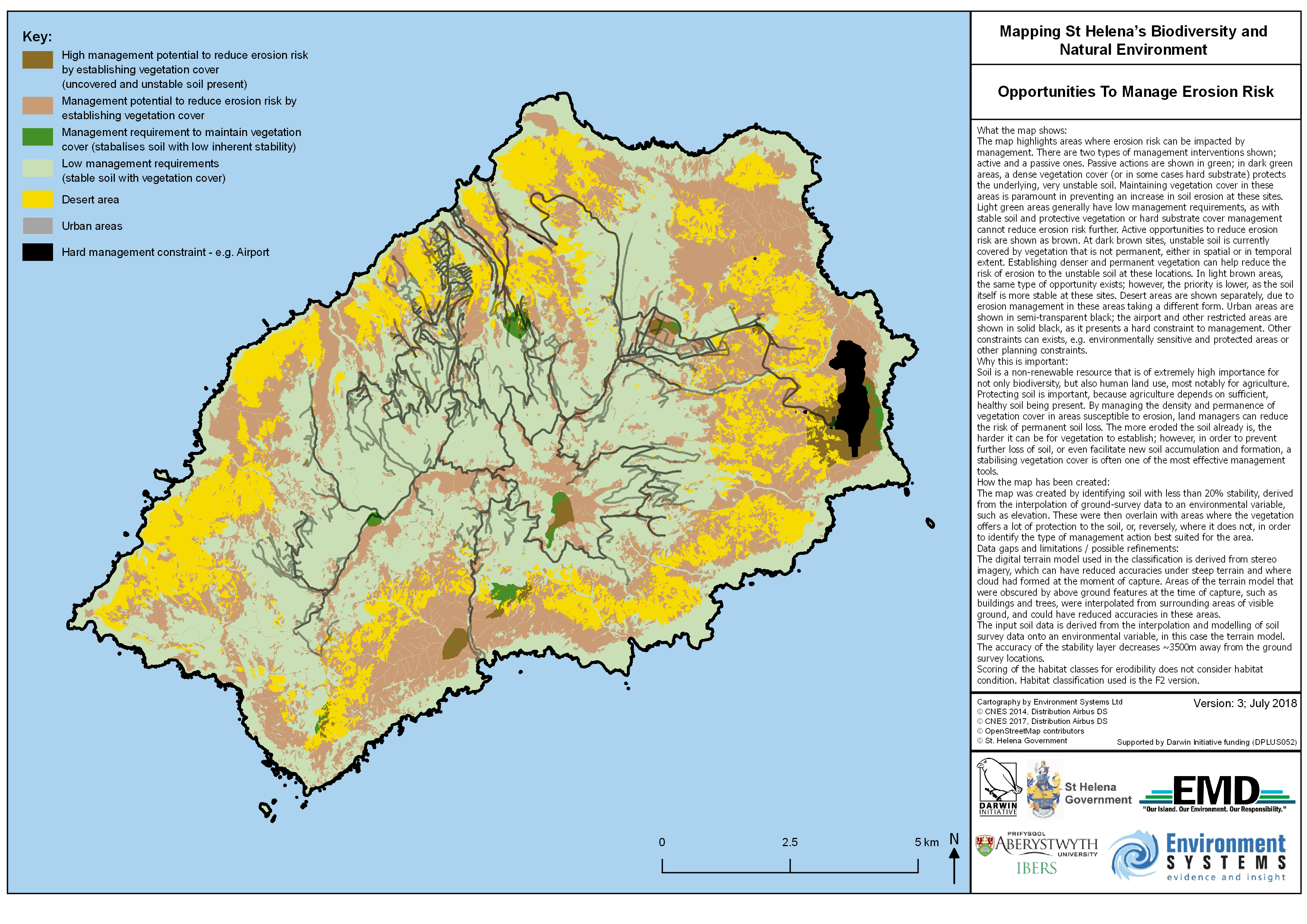
Water Quality
Risk Of High Sediment Load In Drainage Channels And Streams
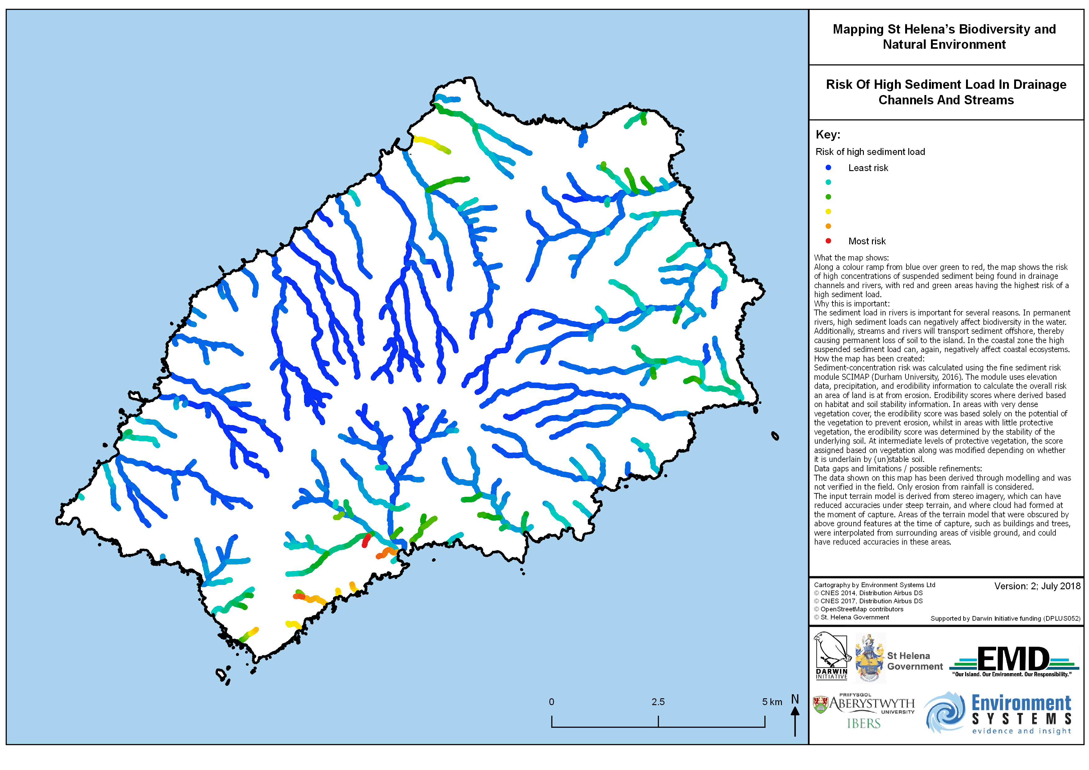
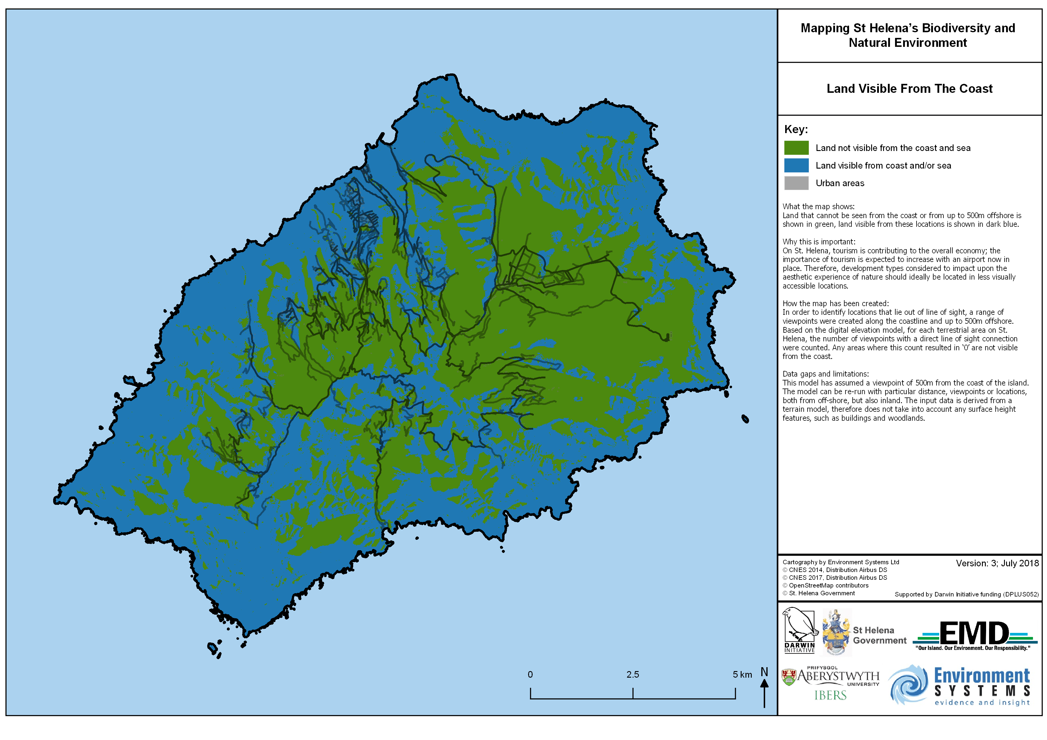
Flat Land Case Study
Development Opportunities on Flat Land (Less than 7°) That Cannot Be Seen From The Coast
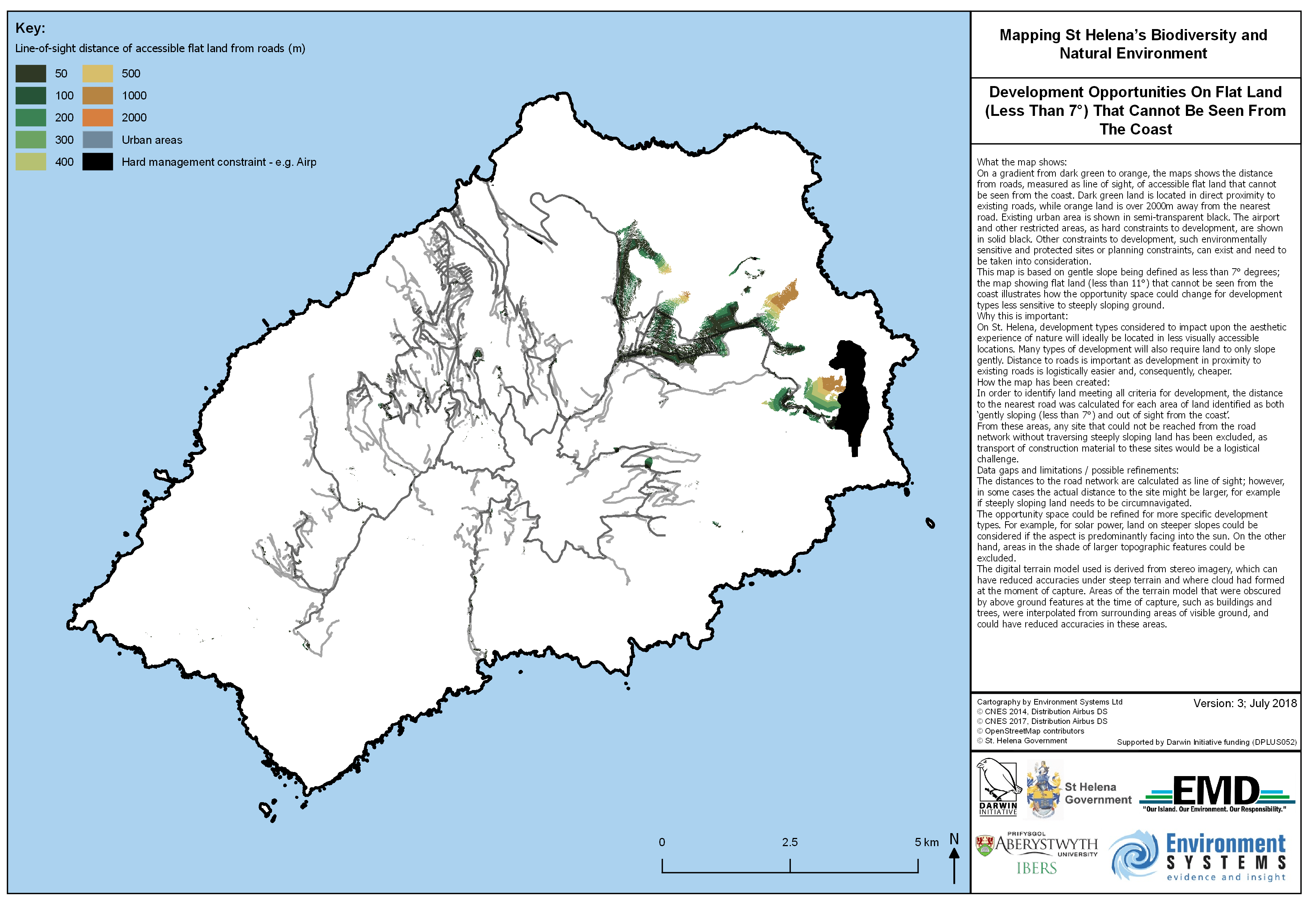
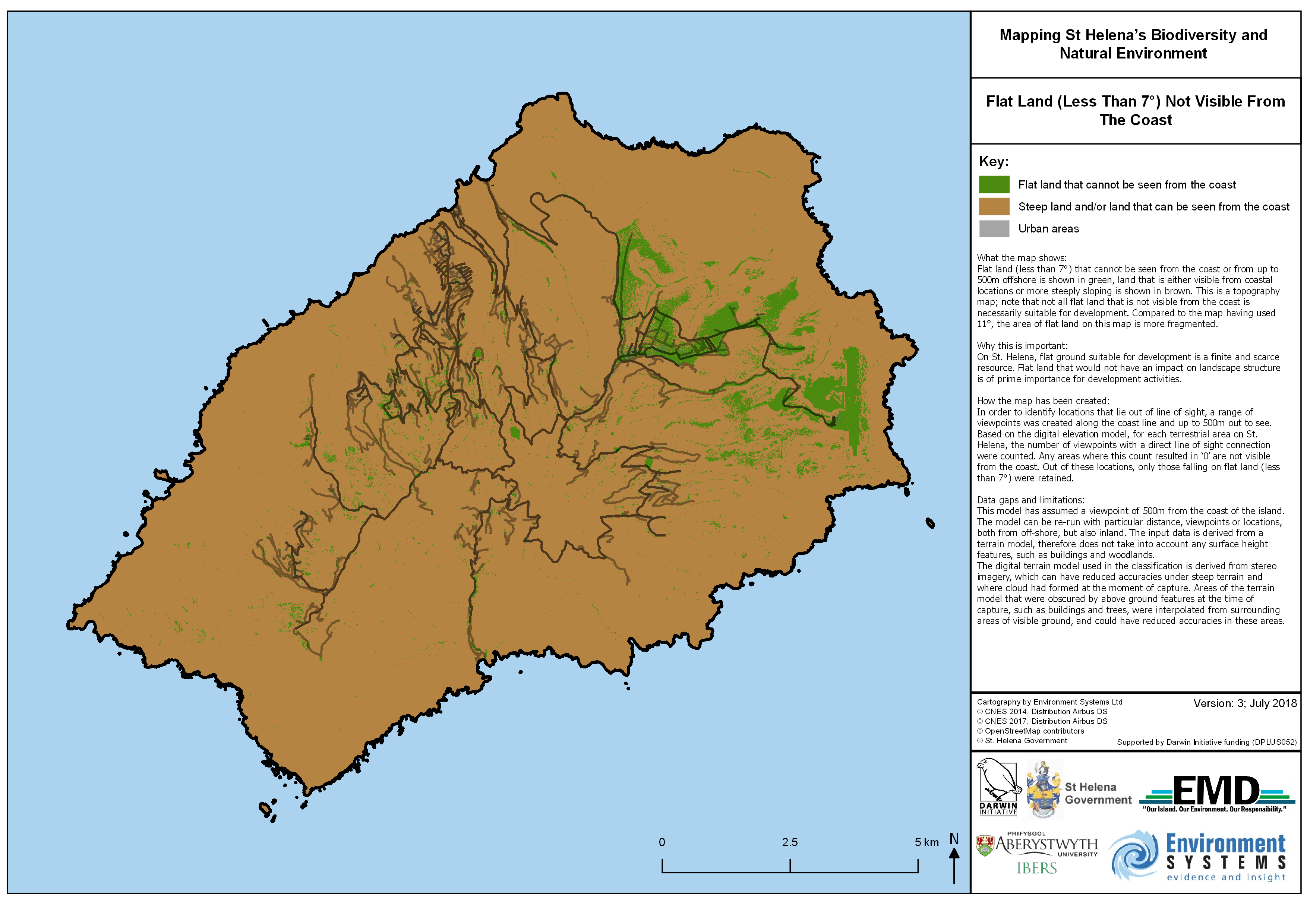
Flat Land (Less Than 7°) Not Visible From The Coast
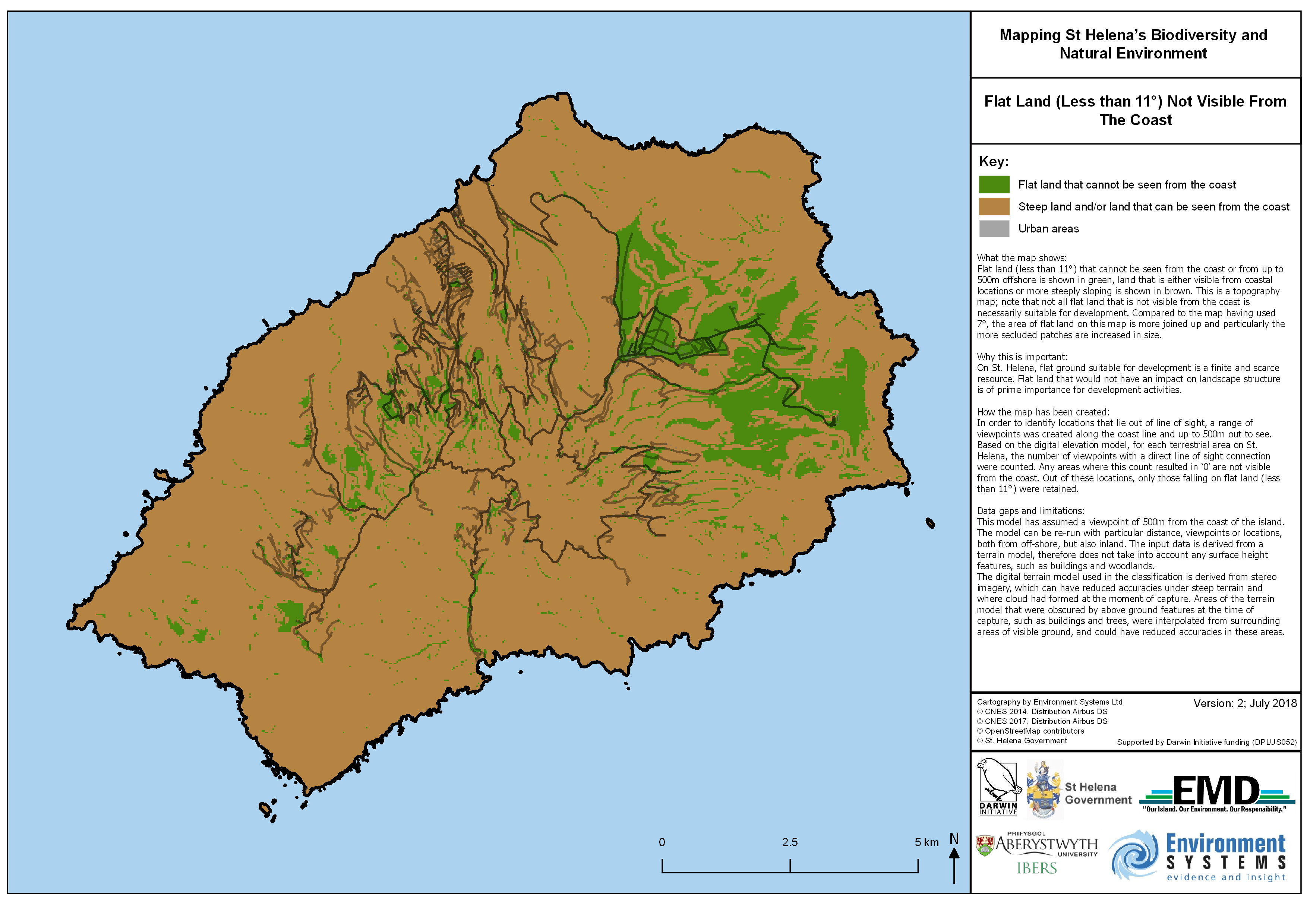
Flat Land (Less Than 11°) Not Visible From The Coast
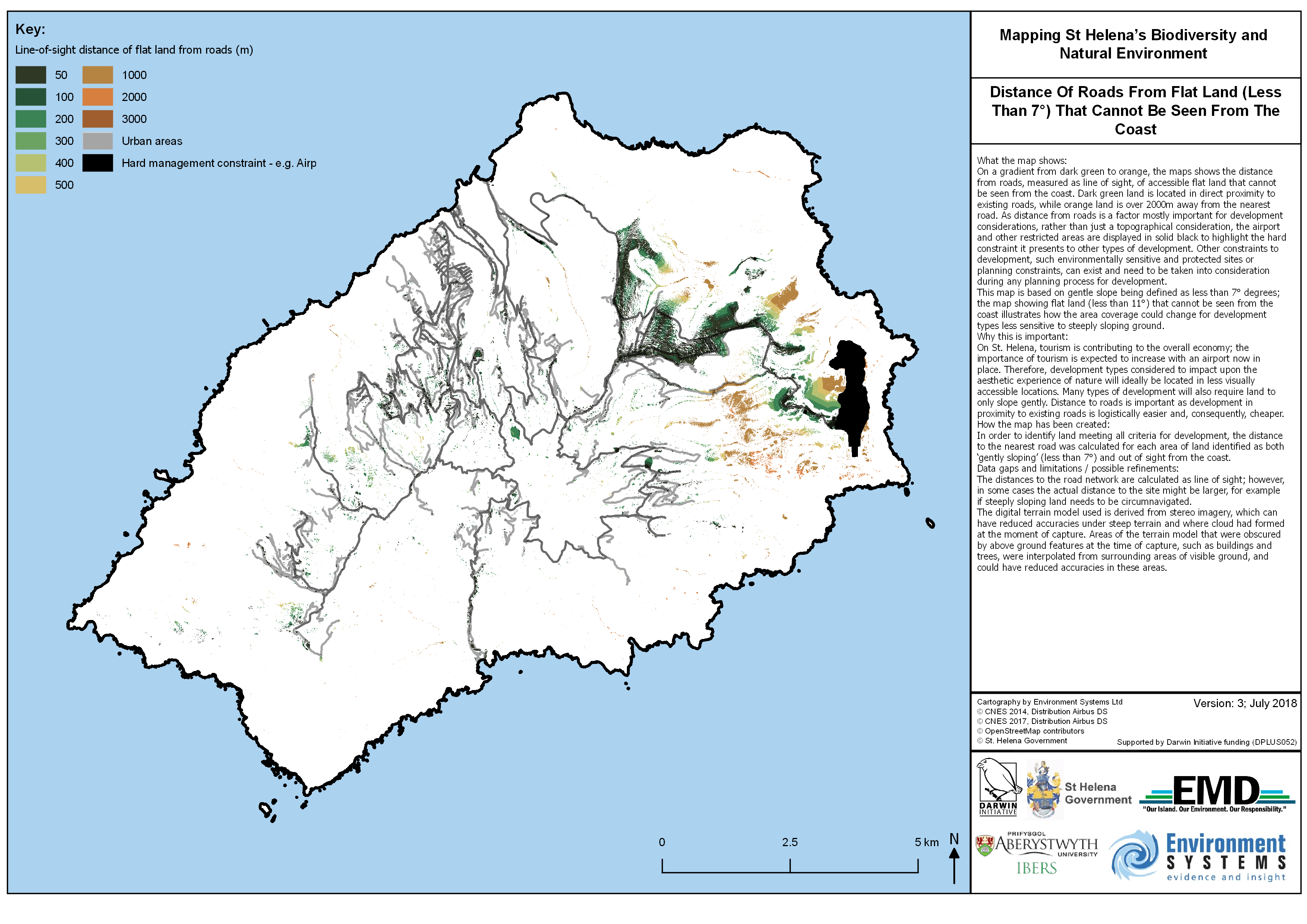
Distance Of Roads From Flat Land (Less Than 7°) That Cannot Be Seen From The Coast
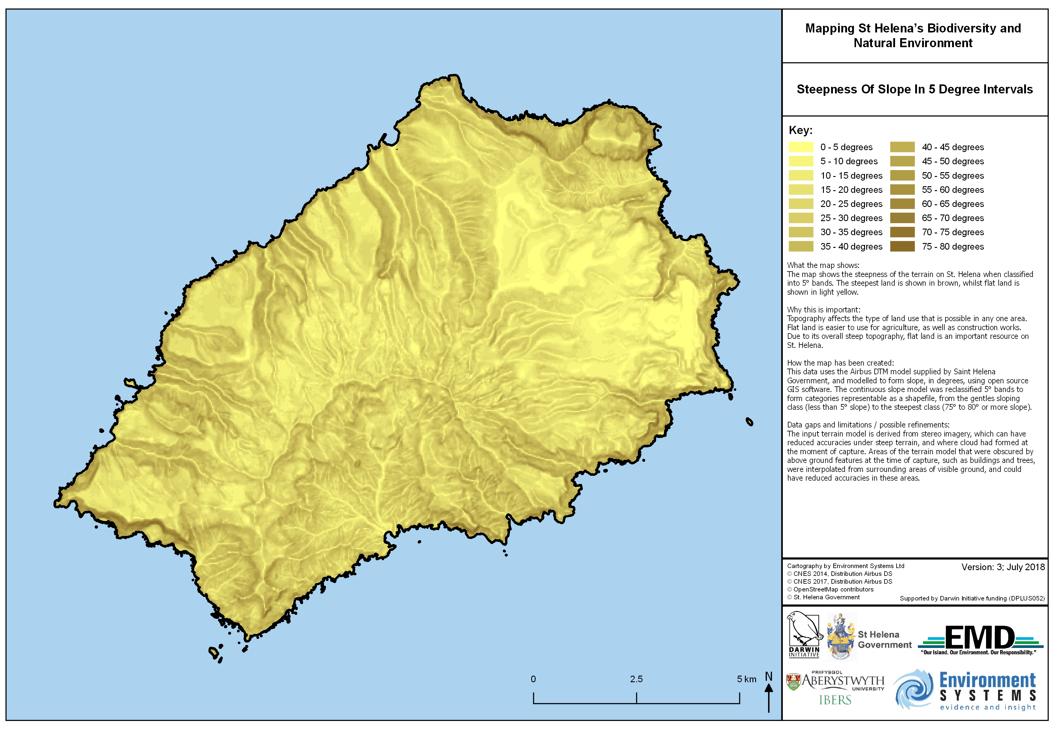
Steepness of Slope in 5 Degree Intervals
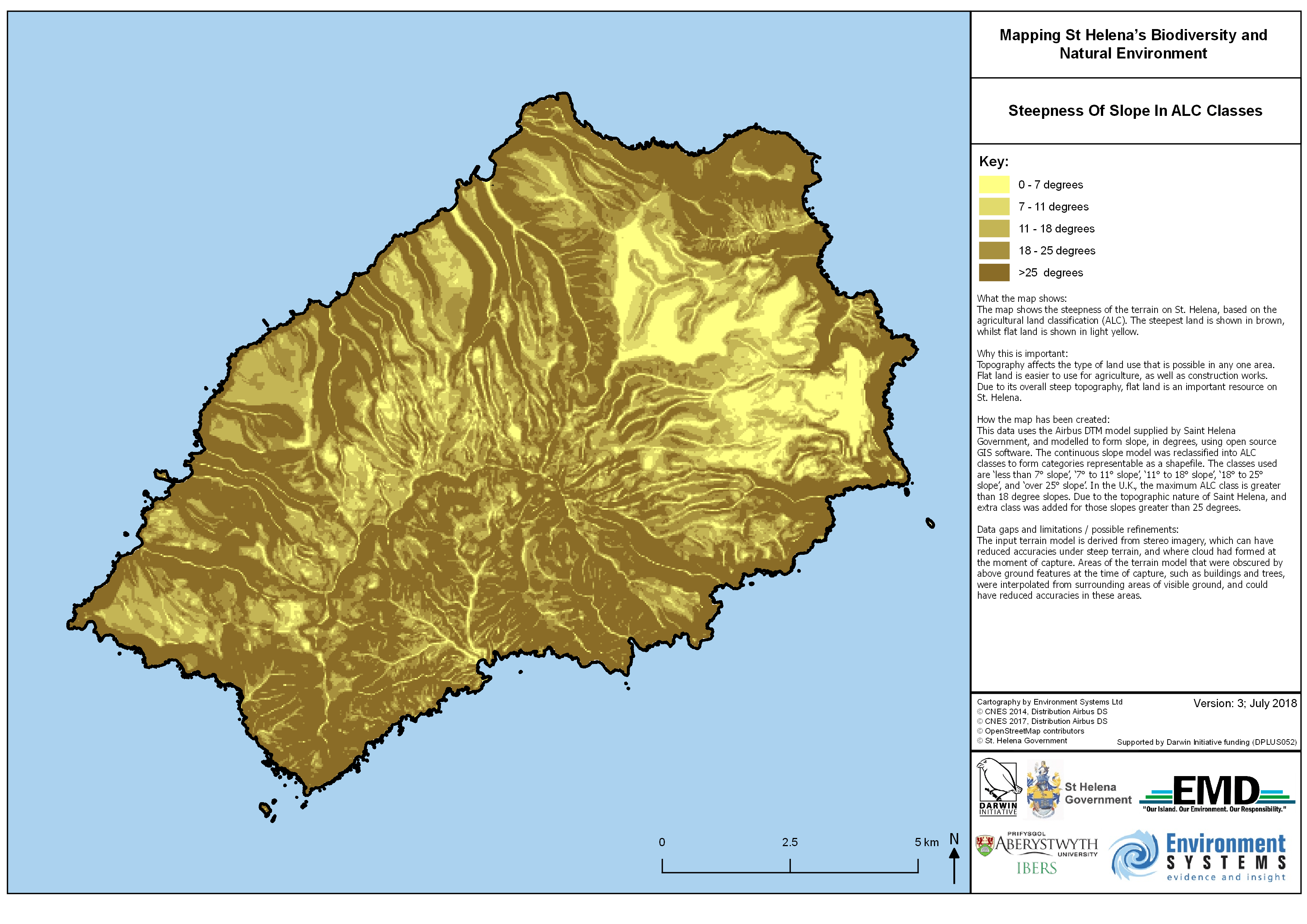
Steepness Of Slope In ALC Classes
Our Project Partners
Environment Systems Ltd (http://www.envsys.co.uk/)
Environment Systems is an established environmental and agricultural data company, providing trusted evidence and insight to governments and industry across the world since 2003. The consultancy delivers bespoke advice and solutions for land management, monitoring and policy for ecosystems, natural capital evaluation, agricultural trials and agricultural supply chains. The company’s recently launched satellite data services deliver always-on, accessible open data insights from satellite earth observations analytics.
IBERS – Aberystwyth University
(www.aber.ac.uk and https://www.aber.ac.uk/en/ibers/)
An internationally-recognised research centre providing research on global challenges such as food security, bioenergy, sustainability and climate change impacts. Over £55 million has been received from EU/RCUK funds over the past 5 years. IBERS conduct research on genes and molecules, whole organisms and the environment. It is the largest UK land-based Institute; in the Research Excellence Framework (REF) 78% of research was world-leading or internationally excellent; 76% was judged to have outstanding societal and economic impacts. The Institute has particular expertise in land use-soil interactions and links to environmental services/ecosystem function.
South Atlantic Environmental Research Institute (SAERI)
(https://www.south-atlantic-research.org/)
The South Atlantic Environmental Research Institute (SAERI), based in the Falkland Islands, aspires to increase and coordinate the volume and impact of natural and physical sciences in the South Atlantic (SA), from the tropics down to the ice in the Antarctic, by establishing world-class research platforms, teaching students, and building capacity within and between the SA Overseas Territories. SAERI research activities include as well geographic information systems (GIS). Within SAERI, the Information Management System (IMS) and GIS data centre was developed with the intention of establishing a data infrastructure for managing existing and future data (environmental and otherwise) in a consistent way across the entire SA region. The GIS data centre aims at building local GIS capacity, skills and knowledge by delivering training courses in open source GIS tools and data management systems. The data centre, in collaboration with the University of Dundee, is developing more practical and useful data tools/services with the intent of helping the outcomes of research projects to have a longer term and beneficial impact on the local communities.