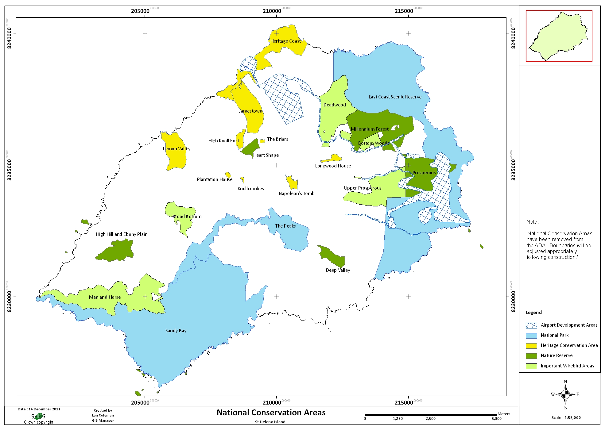
St Helena has designated 23 National Conservation Areas (NCAs) under the Land Development Control Plan. The NCAs are split into four types: National Parks (3); Nature Reserves (6); Important Wirebird Areas (5) and Historic Conservation Areas (9). The Environmental Management Division (EMD) will be leading the development of plans to guide the management of the 14 ‘natural’ NCAs i.e the National Parks, Nature Reserves and Important Wirebird Areas.
The first plan to be developed was the Peaks National Park Management Development Plan. After informal consultation with stakeholders, a draft of the plan was presented to the Environment and Natural Resources Committee. This draft then went out for formal public consultation. After incorporating comments from the public consultation phase, the plan is now ready for final approval from the Land Planning and Development Board, after which it then becomes a formal legal document.
Informal consultation with stakeholders has also occurred for the Sandy Bay National Park and Man and Horse Important Wirebird Area Development Management Plans, and drafts will be available soon.
A draft of the Island’s Nature Reserve plan has been composed with input from the Marine Conservation Section of EMD, and we will be conducting consultation with key stakeholders shortly.
The next NCA plans we will be developing are for the Millennium Forest Nature Reserve, in conjunction with the St Helena National Trust, and the Deep Valley Nature Reserve.
Click here for an Overview of National Conservation Areas
For more information contact Terrestrial Conservation Officer, Lourens Malan, on email: lourens.malan@sainthelena.gov.sh or via tel: 22270, or drop in and speak to us at Essex House, Jamestown.